IMAGES TAKEN NEAR TO
Gas Lane, FAIRFORD, GL7 4GF
Introduction
This page details the photographs taken nearby to Gas Lane, GL7 4GF by members of the Geograph project.
The Geograph project started in 2005 with the aim of publishing, organising and preserving representative images for every square kilometre of Great Britain, Ireland and the Isle of Man.

There are currently over 7.5m images from over14,400 individuals and you can help contribute to the project by visiting https://www.geograph.org.uk
Image Map
Images are licensed for reuse under creativecommons.org/licenses/by-sa/2.0
Notes
- Clicking on the map will re-center to the selected point.
- The higher the marker number, the further away the image location is from the centre of the postcode.
Image Listing (204 Images Found)
Images are licensed for reuse under creativecommons.org/licenses/by-sa/2.0
Image
Details
Distance
1
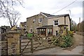
Retort House, Gas Lane, Fairford
Retort House is located where Fairford's first gasworks was, which supplied gas to the town until 1972. In view of the rather unusual appearance of the house, it is possible that a part of the gas company's buildings was incorporated into the house.
See also:- Image
Image: © P L Chadwick
Taken: 11 Mar 2011
0.01 miles
2
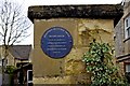
Wall plaque at Retort House, Gas Lane, Fairford
The plaque records that Retort House was the site of the original Fairford Gas and Coke Company, which was formed in 1852 and supplied gas to Fairford until 1972.
Image
Image: © P L Chadwick
Taken: 11 Mar 2011
0.01 miles
3
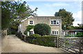
Gas Lane, Fairford
The other side of the property shown in Image
It's hard to believe that this pleasant house down a quiet drive was once part of Fairford Gasworks.
Image: © Des Blenkinsopp
Taken: 11 Sep 2021
0.01 miles
4
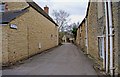
Gas Lane (River Walk), Fairford
Gas Lane is a turning off the street called Back Lane. Gas Lane leads down to the River Coln, where a bridge enables you to cross the river, and walk into the countryside. The lane received its name, because Fairford's original gasworks were situated further along the lane.
Image: © P L Chadwick
Taken: 11 Mar 2011
0.02 miles
5
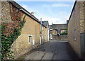
Gas Lane and Back Lane
Fairford Gas Works was down here, a short way behind me.
Image: © Des Blenkinsopp
Taken: 11 Sep 2021
0.02 miles
6
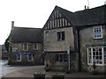
White Hart Court
Old Cotswold stone cottages at the junction of Fairford's Bridge Street and Market Place.
Image: © Colin Smith
Taken: 27 Dec 2007
0.02 miles
7
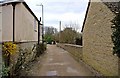
Looking towards the end of Gas Lane, Fairford
In the far distance a wooden fence can be seen. To the immediate right of that, a footpath commences, which goes down to the River Coln, which is crossed by a footbridge known as Dilly's Bridge.
Image
Image: © P L Chadwick
Taken: 11 Mar 2011
0.03 miles
8
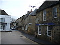
Looking along London Street
Central Fairford's main road is busy with traffic on the Cirencester-Lechlade road, passing closely by the old stone houses. White Hart Court, at corner of Bridge Street and Back Lane, carries dates of 1475-1990. These cottages housed masons involved in building St Mary's Church, later they became the White Hart Inn, and today are once more homes.
Image: © Colin Smith
Taken: 27 Dec 2007
0.03 miles
9
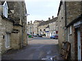
Back Lane, Fairford
Cotswold stone-lined lane, looking across to the Market Place where the large gabled building is Colston House.
Image: © Colin Smith
Taken: 27 Dec 2007
0.03 miles