
IMAGES TAKEN NEAR TO
Hazel View, FAIRFORD, GL7 4FA
Introduction
This page details the photographs taken nearby to Hazel View, GL7 4FA by members of the Geograph project.
The Geograph project started in 2005 with the aim of publishing, organising and preserving representative images for every square kilometre of Great Britain, Ireland and the Isle of Man.

There are currently over 7.5m images from over14,400 individuals and you can help contribute to the project by visiting https://www.geograph.org.uk
Image Map
Images are licensed for reuse under creativecommons.org/licenses/by-sa/2.0
Notes
- Clicking on the map will re-center to the selected point.
- The higher the marker number, the further away the image location is from the centre of the postcode.
Image Listing (17 Images Found)
Images are licensed for reuse under creativecommons.org/licenses/by-sa/2.0
Image
Details
Distance
1
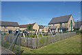
Playground and New Houses, Hazel View
A recent development off Top Road, Kempsford.
Image: © Des Blenkinsopp
Taken: 20 Jun 2022
0.02 miles
3
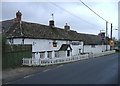
The Axe and Compass, Kempsford
At the north end of the village.
Image: © Roger Cornfoot
Taken: 5 Feb 2007
0.09 miles
4
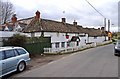
Axe & Compass (1), High Street, Kempsford
This pub, which is believed to date from around the middle of the 19th century, apparently closed in 2008. An application was made to turn it into housing units, but it seems this was withdrawn in February 2011. The reasons for this are not known. It seems a great pity if this pub is lost, particularly as progress is being made on the restoration of the Thames & Severn Canal. Although it is probably many years before the Kempsford section receives attention, it would bring more visitors to the village.
Image
Image
Image
Image: © P L Chadwick
Taken: 11 Mar 2011
0.09 miles
5
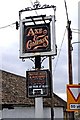
Axe & Compass (2) - pub sign, High Street, Kempsford
Currently closed and its future uncertain. It has been here before, when the then owners wanted to close it in 1996. Cotswold District Council rejected the application, and it re-opened, apparently under new owners.
More photos:- Image
Image: © P L Chadwick
Taken: 11 Mar 2011
0.09 miles
6
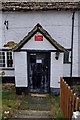
Axe & Compass (3) - entrance door, High Street, Kempsford
The notice on the door says "Pub not open". Above is a warning about hidden CCTV cameras. I can remember this pub in the 1980's, when it had a tremendous atmosphere. It would be good if it could be saved, but in the present climate that is probably unlikely.
More photos:- Image
Image: © P L Chadwick
Taken: 11 Mar 2011
0.09 miles
7
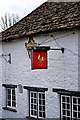
Axe & Compass (4) - Courage sign, High Street, Kempsford
At one time there were a large number of Courage branded pubs across the country. The company changed hands many times, during the process of which the tied public houses were transferred to another company and since then many, such as this one, were sold off. Even the giant Courage Brewery in Reading was closed in 2010, and the right to brew Courage ales has passed to Wells & Young's Brewing Company of Bedford.
The Courage sign on the Axe & Compass, was once a familiar sight across the country, but today not a lot of them remain, so this is quite an interesting historical artefact.
More photos:- Image
Image: © P L Chadwick
Taken: 11 Mar 2011
0.09 miles
8
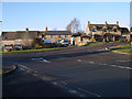
Mount Pleasant, Kempsford
A row of Cotswold stone cottages on the edge of Kempsford.
Image: © Vieve Forward
Taken: 18 Dec 2012
0.10 miles
10
Whelford Road at the junction of Top Road
Image: © David Howard
Taken: 10 Aug 2019
0.16 miles