
IMAGES TAKEN NEAR TO
Whelford Road, FAIRFORD, GL7 4DT
Introduction
This page details the photographs taken nearby to Whelford Road, GL7 4DT by members of the Geograph project.
The Geograph project started in 2005 with the aim of publishing, organising and preserving representative images for every square kilometre of Great Britain, Ireland and the Isle of Man.

There are currently over 7.5m images from over14,400 individuals and you can help contribute to the project by visiting https://www.geograph.org.uk
Image Map
Images are licensed for reuse under creativecommons.org/licenses/by-sa/2.0
Notes
- Clicking on the map will re-center to the selected point.
- The higher the marker number, the further away the image location is from the centre of the postcode.
Image Listing (9 Images Found)
Images are licensed for reuse under creativecommons.org/licenses/by-sa/2.0
Image
Details
Distance
1
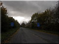
Road to Whelford and Kempsford
Just off the A417 between Lechlade and Fairford. The blue signs say "Welcome to the Cotswold Water Park"
Image: © andrew auger
Taken: 1 Nov 2009
0.03 miles
2
The road to Whelford
If it has a name I can't find it
Image: © David Howard
Taken: 10 Aug 2019
0.04 miles
3
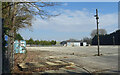
A Large Empty Yard
A bit of post industrial dereliction in the middle of the Cotswold Water Park.
The same place is shown 15 years ago in Image when it was still in business.
Image: © Des Blenkinsopp
Taken: 8 Mar 2022
0.09 miles
5
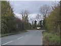
Minor road joins the A417 east of Fairford
Image: © Sarah Charlesworth
Taken: 5 Nov 2009
0.10 miles
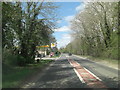
7
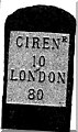
Old Milestone by the A417, Fairford parish
Metal plate attached to stone post by the A417, in parish of FAIRFORD (COTSWOLD District), East of garage, East of Whelford turning, by the road, on South side of road. Cirencester iron plate, erected by the Cirencester to St John's Bridge turnpike trust in the 19th century. For a more recent image see Image
Inscription reads:-
CIRENR
10
LONDON
80
Milestone Society National ID: GL_LG80.
Image: © JM Weightmann
Taken: 1 Dec 1999
0.11 miles
8
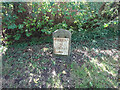
Old Milestone, A417
Metal plate attached to stone post by the A417, in parish of FAIRFORD (COTSWOLD District), E of garage, E of Whelford turning., by the road, on South side of road. Cirencester iron plate Erected by the Cirencester to St John's Bridge turnpike trust in the 19th century.
Inscription reads: CIRENᴿ / 10 / LONDON / 80
Milestone Society National ID: GL_LG80
Image: © Mr Red
Taken: 9 Oct 2021
0.11 miles
9
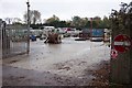
Concrete factory yard
Appear to make kerbstones etc
Image: © Jonathan Billinger
Taken: 14 Nov 2006
0.14 miles