
IMAGES TAKEN NEAR TO
Royal Air Force Station, FAIRFORD, GL7 4DQ
Introduction
This page details the photographs taken nearby to Royal Air Force Station, GL7 4DQ by members of the Geograph project.
The Geograph project started in 2005 with the aim of publishing, organising and preserving representative images for every square kilometre of Great Britain, Ireland and the Isle of Man.

There are currently over 7.5m images from over14,400 individuals and you can help contribute to the project by visiting https://www.geograph.org.uk
Image Map
Images are licensed for reuse under creativecommons.org/licenses/by-sa/2.0
Notes
- Clicking on the map will re-center to the selected point.
- The higher the marker number, the further away the image location is from the centre of the postcode.
Image Listing (8 Images Found)
Images are licensed for reuse under creativecommons.org/licenses/by-sa/2.0
Image
Details
Distance
1
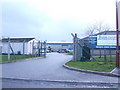
Douglas Bader House
The RAF Charitable Trust's headquarters building at Horcott Hill, Fairford.
Image: © Jonathan Billinger
Taken: 28 Feb 2007
0.09 miles
2
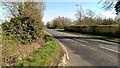
Horcott Road, Horcott, Fairford
At the right is the main entrance to RAF Fairford, built originally in 1944 as part of the D-Day operation to wrest Europe back from the German Nazi regime. It has since served as the test centre for the Concorde supersonic aircraft (from 1969 to 1977) and as a base for USAF KC135 air to air refuelling tankers (1978 to 1990). Since 2010 it has been classified as a standby base and has no operational aircraft based there. It can however be brought back into use within one to two days if necessary. It is the home for the annual Royal International Air Tattoo airshow held every July.
Image: © Brian Robert Marshall
Taken: 1 Apr 2014
0.11 miles
3
Horcott Road northeast of Totterdown Farm
Image: © Stuart Logan
Taken: 13 Apr 2014
0.12 miles
4
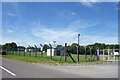
Military Fencing, Fairford Airfield
There's a lot of that round here. The large military airbase at Fairford gets into at least ten of the adjacent squares.
Image: © Des Blenkinsopp
Taken: 20 Jun 2022
0.12 miles
5
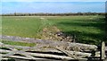
Gate and field, Horcott, Fairford
Seldom have I encountered such an inspiring view.
Image: © Brian Robert Marshall
Taken: 1 Apr 2014
0.12 miles
6
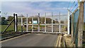
Gate, Deleware Road, Horcott, Fairford
All the maps I have consulted insist on misspelling what was surely meant to be 'Delaware'. Since the other road names behind the gate refer to states of the Union, such as Texas, Kansas and Florida, it is reasonable to assume that the name is meant to represent the second smallest of the United States. The brown sign prohibits the use of tobacco on the 'installation' except in 'designated tobacco areas'. The site is part of the nearby Royal Air Force station occasionally used by the United States Air Force as a base for bombing missions. At one time the station was under the control of the Americans and the road names here probably reflect that.
Image: © Brian Robert Marshall
Taken: 1 Apr 2014
0.13 miles
7
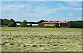
Hay Field near the Airfield
Looking across new mown hay towards some buildings on the Fairford Airbase.
Image: © Des Blenkinsopp
Taken: 20 Jun 2022
0.20 miles
8
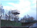
Water tower on Horcott Hill
This structure probably serves the RAF base nearby, rather than Fairford town.
Image: © Jonathan Billinger
Taken: 28 Feb 2007
0.24 miles