
IMAGES TAKEN NEAR TO
LECHLADE, GL7 3BB
Introduction
This page details the photographs taken nearby to GL7 3BB by members of the Geograph project.
The Geograph project started in 2005 with the aim of publishing, organising and preserving representative images for every square kilometre of Great Britain, Ireland and the Isle of Man.

There are currently over 7.5m images from over14,400 individuals and you can help contribute to the project by visiting https://www.geograph.org.uk
Image Map
Images are licensed for reuse under creativecommons.org/licenses/by-sa/2.0
Notes
- Clicking on the map will re-center to the selected point.
- The higher the marker number, the further away the image location is from the centre of the postcode.
Image Listing (30 Images Found)
Images are licensed for reuse under creativecommons.org/licenses/by-sa/2.0
Image
Details
Distance
1
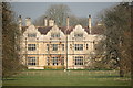
Lechlade Manor
Viewed here along a now depleted avenue of chestnut trees from the public footpath which runs across the manor parkland.
A large country house built in 1872-3 in the Jacobean Style. From 1939 to 1998 it was run as a convent school by sisters of The Order of St. Clotilde. See http://www.francisfrith.com/lechlade/photos/the-convent-of-st-clotilde-c1960_l147039/ for a view in 1960 and some reminiscences.
Image: © Rob Noble
Taken: 25 Mar 2011
0.00 miles
2
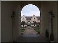
The Stables, Lechlade
A modern development by ALP Architects including 3 individual houses and 22 homes in the parkland surrounding Lechlade Manor. The design followed extensive research into stable blocks often found in the grounds of large houses. See Image
Image: © Vieve Forward
Taken: 25 Mar 2014
0.07 miles
3
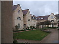
The Stables, Lechlade
A modern development by ALP Architects including 3 individual houses and 22 homes in the parkland surrounding Lechlade Manor. The design followed extensive research into stable blocks often found in the grounds of large houses. See Image
Image: © Vieve Forward
Taken: 25 Mar 2014
0.08 miles
6
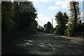
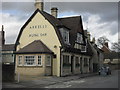
A361 through Lechlade (1)
Heading towards the town centre.
Image: © andrew auger
Taken: 10 Oct 2009
0.16 miles
7
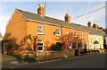
Rose Villas on Hambidge Lane
The plaque on the wall reads Rose Villas 1894.
Image: © Steve Daniels
Taken: 12 Nov 2013
0.17 miles
8

Rose Villas, Hambidge Lane, Lechlade
The tablet on the terrace of red brick houses is dated 1894. Here in Lechlade on the southern fringe of the Cotswolds, the majority of the period buildings are built or faced with Cotswold stone, but a few, mostly Victorian as here, are of brick construction.
Image: © Rob Noble
Taken: 8 Jul 2012
0.17 miles
9
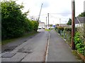
Access road to car park etc., Lechlade on Thames, Glos
This short road off Oak Street (part of the A361) gives access to a free car park operated by Lechlade Town Council, and to the new memorial hall and pavilion.
Image
Image: © P L Chadwick
Taken: 6 Oct 2017
0.20 miles
10
Co-operative store and Texaco petrol station, Station Road, Lechlade
Image: © Vieve Forward
Taken: 12 Mar 2014
0.20 miles