IMAGES TAKEN NEAR TO
Bowling Green Avenue, CIRENCESTER, GL7 2HB
Introduction
This page details the photographs taken nearby to Bowling Green Avenue, GL7 2HB by members of the Geograph project.
The Geograph project started in 2005 with the aim of publishing, organising and preserving representative images for every square kilometre of Great Britain, Ireland and the Isle of Man.

There are currently over 7.5m images from over14,400 individuals and you can help contribute to the project by visiting https://www.geograph.org.uk
Image Map
Images are licensed for reuse under creativecommons.org/licenses/by-sa/2.0
Notes
- Clicking on the map will re-center to the selected point.
- The higher the marker number, the further away the image location is from the centre of the postcode.
Image Listing (15 Images Found)
Images are licensed for reuse under creativecommons.org/licenses/by-sa/2.0
Image
Details
Distance
1
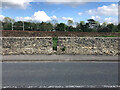
Stone Stile, Cirencester
Off the Whiteway, not on a registered footpath, this view SE leads to the sports field. The view to the road is Image
Image: © Jayne Tovey
Taken: 22 Sep 2022
0.17 miles
2
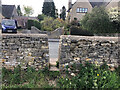
Stone Stile, Cirencester
Off the Whiteway, not on a registered footpath, this view NW leads from the sports field. The view from the road is Image
Image: © Jayne Tovey
Taken: 22 Sep 2022
0.17 miles
3
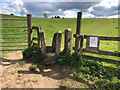
Stone Stile, Stratton near Cirencester
Off Bowling Green Road on Gloucestershire footpath ZCC9 looking SE. The view looking North to the farmhouse is Image Construction is of concrete posts to form a squeeze stile with plywood additions to narrow the aperture.
Image: © Jayne Tovey
Taken: 15 Apr 2021
0.19 miles
4
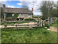
Stone Stile, Stratton near Cirencester
Off Bowling Green Road on Gloucestershire footpath ZCC9 looking North. The view looking SE is Image Construction is of concrete posts to form a squeeze stile with plywood additions to narrow the aperture.
Image: © Jayne Tovey
Taken: 16 Apr 2021
0.19 miles
5
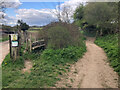
Stone Stile, Stratton near Cirencester
Adjacent to Lower Bowling Green Farm at the end of Bowling Green Road. On Gloucestershire footpath ZCC11 looking North. The view South towards the road is Image
Image: © Jayne Tovey
Taken: 15 Apr 2021
0.21 miles
6
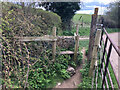
Stone Stile, Stratton near Cirencester
Adjacent to Lower Bowling Green Farm at the end of Bowling Green Road. On Gloucestershire footpath ZCC11 looking South. The view North is Image
Image: © Jayne Tovey
Taken: 15 Apr 2021
0.21 miles
7
![Cirencester parks and spaces [6]](https://s3.geograph.org.uk/geophotos/06/37/47/6374783_c8809dc6_120x120.jpg)
Cirencester parks and spaces [6]
Alongside Abbey Way, A435, is this small area of parkland. The River Churn flows along the left edge of the park and this area is frequently flooded.
Cirencester, the largest town in the Cotswolds, is a market town some 15 miles south east of Gloucester and some 13 miles north west of Swindon. The town lies on the River Churn, a tributary of the River Thames and is the hub of a network of roads. It is the home of the Royal Agricultural University, founded in 1840. An important Roman settlement known as Corinium, the town, with 240 acres enclosed by walls was second only to London in size.
Image: © Michael Dibb
Taken: 24 Sep 2019
0.23 miles
8
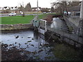
Sluice, Gloucester Street Bridge
Water control measure on the River Churn at Cirencester. The watercourse in the foreground leads to an old mill.
www.cirencester.co.uk
Image: © Colin Smith
Taken: 28 Dec 2011
0.23 miles
9
![Cirencester features [17]](https://s0.geograph.org.uk/geophotos/06/86/15/6861520_202b95dc_120x120.jpg)
Cirencester features [17]
Seen from the bridge that carries Gloucester Street over one arm of the River Churn is a footbridge on the weir of the other arm of the river.
Cirencester, the largest town in the Cotswolds, is a market town some 15 miles south east of Gloucester and some 13 miles north west of Swindon. The town lies on the River Churn, a tributary of the River Thames and is the hub of a network of roads. It is the home of the Royal Agricultural University, founded in 1840. An important Roman settlement known as Corinium, the town, with 240 acres enclosed by walls was second only to London in size.
Image: © Michael Dibb
Taken: 12 May 2021
0.23 miles