
IMAGES TAKEN NEAR TO
Barton Lane, CIRENCESTER, GL7 2EE
Introduction
This page details the photographs taken nearby to Barton Lane, GL7 2EE by members of the Geograph project.
The Geograph project started in 2005 with the aim of publishing, organising and preserving representative images for every square kilometre of Great Britain, Ireland and the Isle of Man.

There are currently over 7.5m images from over14,400 individuals and you can help contribute to the project by visiting https://www.geograph.org.uk
Image Map
Images are licensed for reuse under creativecommons.org/licenses/by-sa/2.0
Notes
- Clicking on the map will re-center to the selected point.
- The higher the marker number, the further away the image location is from the centre of the postcode.
Image Listing (166 Images Found)
Images are licensed for reuse under creativecommons.org/licenses/by-sa/2.0
Image
Details
Distance
1
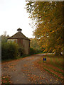
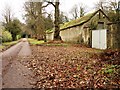
Dovecote, Cirencester Park
Cirencester Park is part of the Bathurst Estate. http://www.cirencesterpark.co.uk/ Visitors are permitted access free of charge to parts of the Park on foot or on horseback daily between 8 am and 5 pm.
Image: © Vieve Forward
Taken: 27 Oct 2015
0.05 miles
2
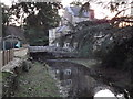
Mill, Barton Lane
View along Mill Pond, on the north-west edge of Cirencester town centre.
www.cirencester.co.uk
Nicholas Henderson 2015 - "There is now a great deal of activity going on with the various authorities concerned regarding the drying up of the Barton Mill Pond (as shown in your photographs). This has followed by letters of complain to the local newspaper as in the summer time the river is drying up when it shouldn't".
Image: © Colin Smith
Taken: 28 Dec 2011
0.07 miles
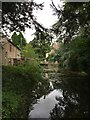
4
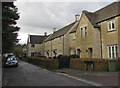
Barton Lane houses, Cirencester
West of the Mill Place junction. http://www.geograph.org.uk/photo/5085401
Image: © Jaggery
Taken: 10 Feb 2016
0.09 miles
6
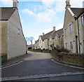
Mill Place, Cirencester
Cul-de-sac and private road on the north side of Barton Lane.
Image: © Jaggery
Taken: 10 Feb 2016
0.13 miles
7
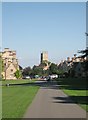
Cirencester Park and Cecily Hill Barracks
Looking east towards Cirencester Parish Church down the main ride of the park, home of Earl Bathurst. On the left are the former barracks, built in 1857 to house the local militia.
Image: © Dave Bushell
Taken: 2 Sep 2005
0.13 miles
8
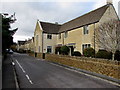
West along Barton Lane, Cirencester
Barton Lane houses are all on the north side, opposite fields and a recreation area.
Image: © Jaggery
Taken: 10 Feb 2016
0.13 miles
9
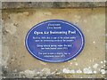
Plaque at Cirencester Lido
For a view of the lido see Image
Image: © Rod Allday
Taken: 19 Aug 2021
0.14 miles
10
![A walk through Cirencester Park and Stratton [6]](https://s3.geograph.org.uk/geophotos/06/84/41/6844135_ab511720_120x120.jpg)
A walk through Cirencester Park and Stratton [6]
The Broad Avenue seen from its junction with Windsor Walk, looking east towards the gates at Cecily Hill. The avenue runs for some 5 miles.
Cirencester Park is a private estate of some 2,500 acres consisting of extensive woodland, with park and pleasure grounds. The park was developed from circa 1714 by the first Earl Bathurst. The park is on the Register of Historic Parks and Gardens, grade I, and there are details at: https://historicengland.org.uk/listing/the-list/list-entry/1000432
Image: © Michael Dibb
Taken: 12 May 2021
0.14 miles