
IMAGES TAKEN NEAR TO
Stroud Road, CIRENCESTER, GL7 1XA
Introduction
This page details the photographs taken nearby to Stroud Road, GL7 1XA by members of the Geograph project.
The Geograph project started in 2005 with the aim of publishing, organising and preserving representative images for every square kilometre of Great Britain, Ireland and the Isle of Man.

There are currently over 7.5m images from over14,400 individuals and you can help contribute to the project by visiting https://www.geograph.org.uk
Image Map
Images are licensed for reuse under creativecommons.org/licenses/by-sa/2.0
Notes
- Clicking on the map will re-center to the selected point.
- The higher the marker number, the further away the image location is from the centre of the postcode.
Image Listing (20 Images Found)
Images are licensed for reuse under creativecommons.org/licenses/by-sa/2.0
Image
Details
Distance
1
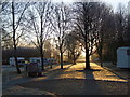
Sunrise at Cirencester Park Caravan Club site
Cirencester Park is part of the Bathurst estate.
Image: © Dennis Turner
Taken: 29 Dec 2016
0.04 miles
2
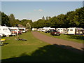
Cirencester Park Caravan Club Site
Caravan site
Image: © Colin Madge
Taken: 26 Jul 2008
0.08 miles
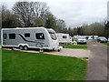
4
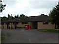
Cirencester Park Caravan Club Site- Facilities Block 1
Image: © Paul Shreeve
Taken: 19 Jul 2008
0.10 miles
5
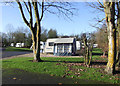
Cirencester Caravan Club site
A members' only site with 210 caravan and motorhome pitches.
Image: © Dennis Turner
Taken: 24 Nov 2012
0.12 miles
6
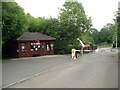
Cirencester Park Caravan Club Site Information centre
Image: © Paul Shreeve
Taken: 20 Jul 2008
0.13 miles
7
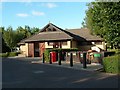
Cirencester Park Caravan Club Site - facilities block 2
Image: © Paul Shreeve
Taken: 19 Jul 2008
0.14 miles
8
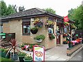
Cirencester Park Caravan Club Site- office
Image: © Paul Shreeve
Taken: 20 Jul 2008
0.14 miles
9
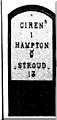
Old Milepost by the A419, Stroud Road, Cirencester
Metal plate attached to wooden post by the A419, in parish of Cirencester (Cotswold District), by "Bailey Lodge" opposite Deer Park School, by the road, on South side of road. Cirencester roundhead iron plate, erected by the Cirencester to Stroud turnpike trust in the 19th century.
Inscription reads:-
CIRENᴿ.
1
HAMPTON
9
STROUD
13
Milestone Society National ID: GL_CISD01
Image: © JM Weightmann
Taken: 1 Nov 1999
0.14 miles
10
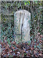
Old Milepost by A419, by "Bailey Lodge" opposite Deer Park School
The Milepost is located by the road on the South of the road. Parish of Cirencester (Cotswold District). Metal plate attached to wooden post, Cirencester roundhead iron plate design, erected by the Cirencester to Stroud turnpike trust in the 19th Century, missing plate, wood beginning to split. An earlier photograph can be found here: https://www.geograph.org.uk/photo/6102899
Inscription reads:-
CIREN.R / 1 / HAMPTON / 9 / STROUD / 13
Milestone Society National ID: GL_CISD01
Image: © Roadside Relics
Taken: 19 Jan 2023
0.15 miles