IMAGES TAKEN NEAR TO
Arnolds Way, CIRENCESTER, GL7 1TA
Introduction
This page details the photographs taken nearby to Arnolds Way, GL7 1TA by members of the Geograph project.
The Geograph project started in 2005 with the aim of publishing, organising and preserving representative images for every square kilometre of Great Britain, Ireland and the Isle of Man.

There are currently over 7.5m images from over14,400 individuals and you can help contribute to the project by visiting https://www.geograph.org.uk
Image Map
Images are licensed for reuse under creativecommons.org/licenses/by-sa/2.0
Notes
- Clicking on the map will re-center to the selected point.
- The higher the marker number, the further away the image location is from the centre of the postcode.
Image Listing (15 Images Found)
Images are licensed for reuse under creativecommons.org/licenses/by-sa/2.0
Image
Details
Distance
1
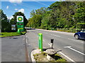
Burford Road, Cirencester at the BP filling station
This is on the line the old Roman Road, Akeman Street.
Image: © Jeff Gogarty
Taken: 27 May 2021
0.06 miles

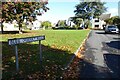
5
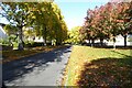
Saxon Road
Trees in autumn colours on Saxon Road on the Beeches estate.
Image: © Philip Halling
Taken: 10 Oct 2022
0.15 miles
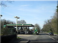
6
Blue Quarry Road
Blue Quarry Road on the Beeches estate.
Image: © Philip Halling
Taken: 10 Oct 2022
0.17 miles
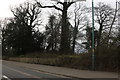
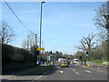
7
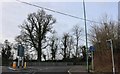
Burford Road at the end of London Road
Image: © David Howard
Taken: 23 Mar 2019
0.18 miles
8
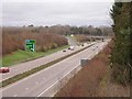
A419/A417 slip road to Cirencester
Unusually, this section of dual-carriageway has a different road number in each direction (A417 northwest to Gloucester, A419 southeast to Swindon).
Image: © Frank Skinner
Taken: 14 Dec 2006
0.18 miles
9
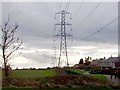
Ironbridge to Minety 400kV Power Transmission Line
The conductors are aluminium instead of the more usual copper. They are very noisy (crackling) to stand under, especially in wet weather.
Image: © Frank Skinner
Taken: 14 Dec 2006
0.18 miles
10
Cirencester Burford Road A429 London Road Joining From Left
Image: © Roy Hughes
Taken: 25 Mar 2017
0.18 miles