
IMAGES TAKEN NEAR TO
Watermoor Road, CIRENCESTER, GL7 1JW
Introduction
This page details the photographs taken nearby to Watermoor Road, GL7 1JW by members of the Geograph project.
The Geograph project started in 2005 with the aim of publishing, organising and preserving representative images for every square kilometre of Great Britain, Ireland and the Isle of Man.

There are currently over 7.5m images from over14,400 individuals and you can help contribute to the project by visiting https://www.geograph.org.uk
Image Map
Images are licensed for reuse under creativecommons.org/licenses/by-sa/2.0
Notes
- Clicking on the map will re-center to the selected point.
- The higher the marker number, the further away the image location is from the centre of the postcode.
Image Listing (217 Images Found)
Images are licensed for reuse under creativecommons.org/licenses/by-sa/2.0
Image
Details
Distance
1
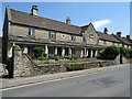
Bowly's Almshouses
Bowly's Almshouses on Watermoor Road was built in 1826. A stone table on the front of the building reads
'BUILT MDCCCXXVI
BY CHRISTOPHER BOWLY
AND ENDOWED BY HIM
MDCCCXXXVII'
Image: © Philip Halling
Taken: 3 Jul 2018
0.01 miles
2
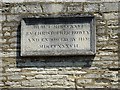
Stone tablet on Bowly's Almshouses
The inscription reads:
'BUILT MDCCCXXVI
BY CHRISTOPHER BOWLY
AND ENDOWED BY HIM
MDCCCXXXVII'
Image: © Philip Halling
Taken: 3 Jul 2018
0.01 miles
3
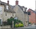
The Twelve Bells, Lewis Lane, Cirencester
Image: © Chris Gunns
Taken: 7 Sep 2009
0.04 miles
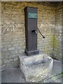
5
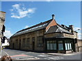
Cirencester Urban District Council Water Works
Before privatisation, one assumes.
Image: © Peter Barr
Taken: 4 May 2013
0.06 miles
6
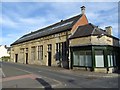
Cirencester Urban District Council Water Works,
The former Cirencester Urban District Council Water Works on Lewis Lane.
Image: © Philip Halling
Taken: 14 Sep 2019
0.06 miles
7
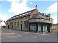
Former water works, Cirencester
A former water works in the town of Cirencester. Another image of the same building, taken 6½ years earlier, is here: Image
The crossroads in the foreground was the junction of two Roman roads, Ermin Street and Fosse Way.
Image: © Malc McDonald
Taken: 11 Jul 2020
0.06 miles
8
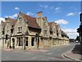
Lewis Lane, Cirencester
Lewis Lane in the town of Cirencester.
The crossroads in the foreground is the site where two Roman roads, Ermin Street and Fosse Way, crossed.
Image: © Malc McDonald
Taken: 11 Jul 2020
0.06 miles
9
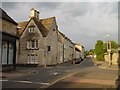
Looking from Lewis Lane down Querns Lane Cirencester
Image: © Paul Best
Taken: 9 Jun 2014
0.06 miles
10
![Cirencester buildings [38]](https://s3.geograph.org.uk/geophotos/06/84/56/6845611_5fe6ba87_120x120.jpg)
Cirencester buildings [38]
The Cirencester UDC Water Works building in Lewis Lane was constructed circa 1897.
Constructed of coursed squared limestone to the front with brick to the sides and rear with a slate roof. The building was used for its original purpose until the 1930s when the water works moved to Baunton. The building had a number of later uses and is now part of a scheme of flats including the adjacent feed mill.
Cirencester, the largest town in the Cotswolds, is a market town some 15 miles south east of Gloucester and some 13 miles north west of Swindon. The town lies on the River Churn, a tributary of the River Thames and is the hub of a network of roads. It is the home of the Royal Agricultural University, founded in 1840. An important Roman settlement known as Corinium, the town, with 240 acres enclosed by walls was second only to London in size.
Image: © Michael Dibb
Taken: 12 May 2021
0.06 miles