
IMAGES TAKEN NEAR TO
Gardner Court, CIRENCESTER, GL7 1JJ
Introduction
This page details the photographs taken nearby to Gardner Court, GL7 1JJ by members of the Geograph project.
The Geograph project started in 2005 with the aim of publishing, organising and preserving representative images for every square kilometre of Great Britain, Ireland and the Isle of Man.

There are currently over 7.5m images from over14,400 individuals and you can help contribute to the project by visiting https://www.geograph.org.uk
Image Map
Images are licensed for reuse under creativecommons.org/licenses/by-sa/2.0
Notes
- Clicking on the map will re-center to the selected point.
- The higher the marker number, the further away the image location is from the centre of the postcode.
Image Listing (76 Images Found)
Images are licensed for reuse under creativecommons.org/licenses/by-sa/2.0
Image
Details
Distance
1
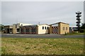
Cirencester Fire Station
Cirencester Fire Station, Chesterton Lane, Cirencester is station W21 of the Gloucestershire Fire & Rescue Service.
Image: © Kevin Hale
Taken: 4 Jun 2006
0.05 miles
3
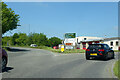
Roundabout exit on A429, Cirencester
The roads here and the nearby commercial development are on the site of the Midland and South Western Junction Railway station and yard, which closed to all traffic in 1964.
Image: © Robin Webster
Taken: 30 May 2021
0.07 miles
4
Former Queens Head Cirencester
Former Queens Head Watermoor Road Cirencester
Historical information links
http://pubshistory.com/Gloucestershire/Cirencester/index.shtml
http://www.gloucestershirepubs.co.uk/FeatureFiller/index.php
Image: © Paul Best
Taken: 28 Mar 2013
0.08 miles
5
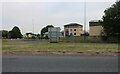
Roundabout on Bristol Road, Cirencester
Image: © David Howard
Taken: 23 May 2020
0.08 miles
6
![Cirencester buildings [21]](https://s2.geograph.org.uk/geophotos/06/27/54/6275434_e32af13c_120x120.jpg)
Cirencester buildings [21]
In Watermoor Road is this row of purpose built shops with accommodation over, dated 1899.
Cirencester, the largest town in the Cotswolds, is a market town some 15 miles south east of Gloucester and some 13 miles north west of Swindon. The town lies on the River Churn, a tributary of the River Thames and is the hub of a network of roads. It is the home of the Royal Agricultural University, founded in 1840. An important Roman settlement known as Corinium, the town, with 240 acres enclosed by walls was second only to London in size.
Image: © Michael Dibb
Taken: 31 Jul 2019
0.09 miles
7
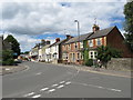
Watermoor Road, Cirencester
Watermoor Road in Cirencester.
Image: © Malc McDonald
Taken: 11 Jul 2020
0.09 miles
8
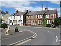
Hare sculpture, Cirencester
A sculpture of a hare on the corner of Watermoor Way and Watermoor Road in Cirencester. Hares feature in the folklore of Cirencester.
Image: © Malc McDonald
Taken: 11 Jul 2020
0.09 miles
9
![Cirencester features [8]](https://s1.geograph.org.uk/geophotos/06/27/54/6275433_24791504_120x120.jpg)
Cirencester features [8]
An information board giving details of the former railway workshops.
Cirencester, the largest town in the Cotswolds, is a market town some 15 miles south east of Gloucester and some 13 miles north west of Swindon. The town lies on the River Churn, a tributary of the River Thames and is the hub of a network of roads. It is the home of the Royal Agricultural University, founded in 1840. An important Roman settlement known as Corinium, the town, with 240 acres enclosed by walls was second only to London in size.
Image: © Michael Dibb
Taken: 31 Jul 2019
0.09 miles
10
Cirencester A419 Bristol Road Island For Industrial Estate
Image: © Roy Hughes
Taken: 25 Mar 2017
0.10 miles