
IMAGES TAKEN NEAR TO
Partridge Way, CIRENCESTER, GL7 1BQ
Introduction
This page details the photographs taken nearby to Partridge Way, GL7 1BQ by members of the Geograph project.
The Geograph project started in 2005 with the aim of publishing, organising and preserving representative images for every square kilometre of Great Britain, Ireland and the Isle of Man.

There are currently over 7.5m images from over14,400 individuals and you can help contribute to the project by visiting https://www.geograph.org.uk
Image Map
Images are licensed for reuse under creativecommons.org/licenses/by-sa/2.0
Notes
- Clicking on the map will re-center to the selected point.
- The higher the marker number, the further away the image location is from the centre of the postcode.
Image Listing (8 Images Found)
Images are licensed for reuse under creativecommons.org/licenses/by-sa/2.0
Image
Details
Distance
1
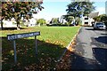
Blue Quarry Road
Blue Quarry Road on the Beeches estate.
Image: © Philip Halling
Taken: 10 Oct 2022
0.06 miles
2
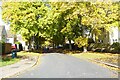
Trees on Saxon Road
Trees in autumn colours on Saxon Road on the Beeches estate.
Image: © Philip Halling
Taken: 10 Oct 2022
0.07 miles
3
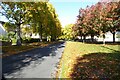
Saxon Road
Trees in autumn colours on Saxon Road on the Beeches estate.
Image: © Philip Halling
Taken: 10 Oct 2022
0.08 miles
4
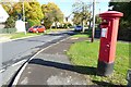
George VI pillar box
George VI pillar box on the corner of Abbots Road and Akeman Road on the Beeches estate.
Image: © Philip Halling
Taken: 10 Oct 2022
0.10 miles
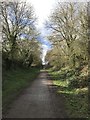
6
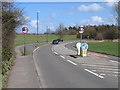
London Road Cirencester
The edge of town as at early 2006. London Road is the A417 which meanders off towards Reading
Image: © Peter Watkins
Taken: 1 Apr 2006
0.19 miles
7
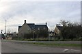
New David Wilson Homes in Cirencester
It appears there is a local window tax in Cirencester going by the size of them.
Image: © David Howard
Taken: 23 Mar 2019
0.22 miles
8
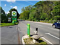
Burford Road, Cirencester at the BP filling station
This is on the line the old Roman Road, Akeman Street.
Image: © Jeff Gogarty
Taken: 27 May 2021
0.25 miles