IMAGES TAKEN NEAR TO
Park Farm Court, STROUD, GL6 9LF

Introduction

This page details the photographs taken nearby to Park Farm Court, GL6 9LF by members of the Geograph project.

The Geograph project started in 2005 with the aim of publishing, organising and preserving representative images for every square kilometre of Great Britain, Ireland and the Isle of Man.

There are currently over 7.5m images from over14,400 individuals and you can help contribute to the project by visiting https://www.geograph.org.uk

Image Map


Images are licensed for reuse under creativecommons.org/licenses/by-sa/2.0
Notes
  • Clicking on the map will re-center to the selected point.
  • The higher the marker number, the further away the image location is from the centre of the postcode.

Image Listing (214 Images Found)

Images are licensed for reuse under creativecommons.org/licenses/by-sa/2.0
  • ...
Image
Details
Distance
1
Park Farm Court, Minchinhampton
At the southern end of School Road.
Image: © Jaggery Taken: 6 Mar 2016
0.00 miles
2
Wooden gate at the entrance to Minchinhampton Community Library car park
Two small notices are on the gate on the west side of School Road. One states that this car park is for library users only. The text on the other one is "Please close this gate when the cows are out. Thank you".
Image: © Jaggery Taken: 6 Mar 2016
0.01 miles
3
Minchinhampton Community Library
Public library viewed across School Road.
Image: © Jaggery Taken: 6 Mar 2016
0.02 miles
4
Minchinhampton Surgery
Medical surgery viewed across School Road. The zigzag lines are part of the Keep Clear zone outside a school.
Image: © Jaggery Taken: 6 Mar 2016
0.03 miles
5
Minchinhampton, West End
Looking towards the centre of the town; mainly stone cottages, with stone roof tiles.
Image: © Mike Faherty Taken: 13 Mar 2011
0.03 miles
6
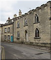
Culver Cottage, West End
Grade II listed former almshouses.
Image: © Graham Hogg Taken: 19 Oct 2021
0.04 miles
7
Distinctive number 18A West End, Minchinhampton
Originally part of a larger dwelling erected c1821 as almshouses for eight aged women. The almshouses were divided into two dwellings in the 1960s.
Image: © Jaggery Taken: 6 Mar 2016
0.04 miles
8
Zigzag yellow markings on School Road, Minchinhampton
Part of the Keep Clear Zone outside Minchinhampton Primary School.
Image: © Jaggery Taken: 6 Mar 2016
0.04 miles
9
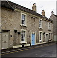
Grade II listed April Cottage, Minchinhampton
April Cottage (with the blue door) at 17 West End dates from the mid 18th century. Grade II listed (together with number 19 on the right) in 1988.
Image: © Jaggery Taken: 6 Mar 2016
0.05 miles
10
Minchinhampton Church of England Primary Academy
Viewed from School Road.
Image: © Jaggery Taken: 6 Mar 2016
0.05 miles
  • ...