
IMAGES TAKEN NEAR TO
Windmill Road, STROUD, GL6 9DZ
Introduction
This page details the photographs taken nearby to Windmill Road, GL6 9DZ by members of the Geograph project.
The Geograph project started in 2005 with the aim of publishing, organising and preserving representative images for every square kilometre of Great Britain, Ireland and the Isle of Man.

There are currently over 7.5m images from over14,400 individuals and you can help contribute to the project by visiting https://www.geograph.org.uk
Image Map
Images are licensed for reuse under creativecommons.org/licenses/by-sa/2.0
Notes
- Clicking on the map will re-center to the selected point.
- The higher the marker number, the further away the image location is from the centre of the postcode.
Image Listing (30 Images Found)
Images are licensed for reuse under creativecommons.org/licenses/by-sa/2.0
Image
Details
Distance
1
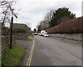
WNW along Windmill Road, Minchinhampton
Windmill Road viewed past the signpost http://www.geograph.org.uk/photo/5035275 opposite Dr Brown's Road.
Image: © Jaggery
Taken: 6 Mar 2016
0.09 miles
2
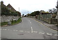
Southern end of Dr Brown's Road, Minchinhampton
Looking north from Windmill Road.
Image: © Jaggery
Taken: 6 Mar 2016
0.11 miles
3
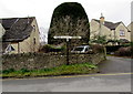
Windmill Road signpost, Minchinhampton
Opposite the southern end of Dr Brown's Road. http://www.geograph.org.uk/photo/5034826
Turn left for Avening and Tetbury. Turn right for Burleigh and Brimscombe.
Image: © Jaggery
Taken: 6 Mar 2016
0.12 miles
4
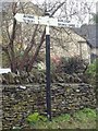
Direction Sign ? Signpost
Located against the dry-stone wall of number 19 on the south side of the junction of Windmill Road and Dr Browns Road in Minchinhampton parish. 2 arms and cap finial. See also https://www.geograph.org.uk/photo/5035275.
Milestone Society National ID: GL_SO8600
Image: © Mr Red
Taken: 22 Jan 2020
0.12 miles
5
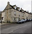
Windmill Road houses and cars, Minchinhampton
On the south side of the road, between the Cuckoo Row junction and the Dr Brown's Road junction.
Image: © Jaggery
Taken: 6 Mar 2016
0.13 miles
6

Terrace of Cotswold stone houses, Minchinhampton
The terrace of about a dozen houses has a gable-ended property at each end
Image: © David Smith
Taken: 8 Jun 2018
0.13 miles
7
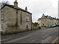
Windmill Road, Minchinhampton
Looking west along Windmill Road from the western end of West End.
Image: © Jaggery
Taken: 6 Mar 2016
0.14 miles
9
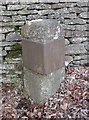
Old Milestone by Windmill Road, Minchinhampton parish
Metal plate attached to stone post by the UC road, in parish of MINCHINHAMPTON (STROUD District), Windmill Road, by bus stop in front of Horsfall House care centre, on South side of road. Avening plate, erected by the Minchinhampton, Tetbury & Bisley turnpike trust in the 19th century.
Inscription once read:-
: (Stroud / 4) : : (Tetbury / 6) :
Milestone Society National ID: GL_SDTB04.
Image: © M Faherty
Taken: 11 Mar 2011
0.15 miles
10
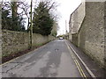
West along Cuckoo Row, Minchinhampton
From the Windmill Road/West End junction.
Image: © Jaggery
Taken: 6 Mar 2016
0.15 miles