IMAGES TAKEN NEAR TO
Manor Close, STROUD, GL6 9DG
Introduction
This page details the photographs taken nearby to Manor Close, GL6 9DG by members of the Geograph project.
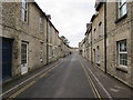
The Geograph project started in 2005 with the aim of publishing, organising and preserving representative images for every square kilometre of Great Britain, Ireland and the Isle of Man.

There are currently over 7.5m images from over14,400 individuals and you can help contribute to the project by visiting https://www.geograph.org.uk
Image Map
Images are licensed for reuse under creativecommons.org/licenses/by-sa/2.0
Notes
- Clicking on the map will re-center to the selected point.
- The higher the marker number, the further away the image location is from the centre of the postcode.
Image Listing (190 Images Found)
Images are licensed for reuse under creativecommons.org/licenses/by-sa/2.0
Image
Details
Distance
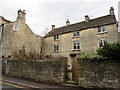
1
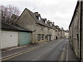
Grade II listed Park Terrace Minchinhampton
Dating from 1833, the row of 14 houses extends for 80 metres from Dr Brown's Road. Grade II listed in 1975.
Image: © Jaggery
Taken: 6 Mar 2016
0.05 miles
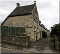
2
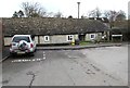
Weavers Cottage, Minchinhampton
Set back several metres from the north side of West End.
Image: © Jaggery
Taken: 6 Mar 2016
0.06 miles
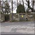
3
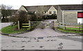
Wooden gate at the entrance to Minchinhampton Community Library car park
Two small notices are on the gate on the west side of School Road.
One states that this car park is for library users only. The text on the other one is
"Please close this gate when the cows are out. Thank you".
Image: © Jaggery
Taken: 6 Mar 2016
0.06 miles
4
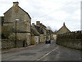
Western end of West End, Minchinhampton
Looking east along West End from the Y-shaped junction of Windmill Road and Cuckoo Row.
Image: © Jaggery
Taken: 6 Mar 2016
0.06 miles
5
West along West End, Minchinhampton
To the west, away from the town centre, towards the Cuckoo Row/Windmill Road junction.
Double yellow lines on both sides of the road indicate no parking in West End at any time.
Image: © Jaggery
Taken: 6 Mar 2016
0.06 miles
6
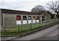
Minchinhampton Community Library
Public library viewed across School Road.
Image: © Jaggery
Taken: 6 Mar 2016
0.06 miles
7
Park Farm Court, Minchinhampton
At the southern end of School Road.
Image: © Jaggery
Taken: 6 Mar 2016
0.07 miles
8
Lockup garages, West End, Minchinhampton
Located near the western end of West End.
Image: © Jaggery
Taken: 6 Mar 2016
0.07 miles
9
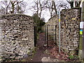
Kissing gate to a public footpath, Minchinhampton
From the south side of Cuckoo Row.
Image: © Jaggery
Taken: 6 Mar 2016
0.07 miles
10
Minchinhampton West electricity substation
Located between a kissing gate and a signpost on the south side of Cuckoo Row. The Western Power Distribution electricity substation identifier is MINCHINHAMPTON W. S/S 9549. A caution label on the substation shows the presence of SF6 (sulphur hexafluoride, an insulating gas used in high voltage systems).
Image: © Jaggery
Taken: 6 Mar 2016
0.07 miles