
IMAGES TAKEN NEAR TO
Commercial Road, STROUD, GL6 8QF
Introduction
This page details the photographs taken nearby to Commercial Road, GL6 8QF by members of the Geograph project.
The Geograph project started in 2005 with the aim of publishing, organising and preserving representative images for every square kilometre of Great Britain, Ireland and the Isle of Man.

There are currently over 7.5m images from over14,400 individuals and you can help contribute to the project by visiting https://www.geograph.org.uk
Image Map
Images are licensed for reuse under creativecommons.org/licenses/by-sa/2.0
Notes
- Clicking on the map will re-center to the selected point.
- The higher the marker number, the further away the image location is from the centre of the postcode.
Image Listing (22 Images Found)
Images are licensed for reuse under creativecommons.org/licenses/by-sa/2.0
Image
Details
Distance
1

View from a footpath west of Marle Hill, Chalford
Chalford is characterized by narrow, steep lanes and has a number of footpaths crossing it. The property in the trees at the left is probably in Dark Lane.
Image: © Brian Robert Marshall
Taken: 24 Oct 2008
0.08 miles
2
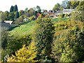
View south-west from Marle Hill, Chalford
Chalford climbs up the steep south-facing slope of the Frome valley. Marle Hill is a narrow hill that leads north from the valley floor.
Image: © Brian Robert Marshall
Taken: 24 Oct 2008
0.09 miles
3

Marle Hill, Chalford
There is a sign at the top entrance to this very narrow road saying 'unsuitable for motor vehicles'. I didn't see one at the bottom but made it up here - just about.
Image: © Brian Robert Marshall
Taken: 24 Oct 2008
0.11 miles
4
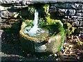
Spout, near Marle Hill, Chalford
The spout is so named on Magic maps. The source of the water is a spring. It is one of several in the area.
Image: © Brian Robert Marshall
Taken: 24 Oct 2008
0.12 miles
5
Spout, near Marle Hill, Chalford
The source of the water flow is a spring.
Image: © Brian Robert Marshall
Taken: 24 Oct 2008
0.12 miles
6
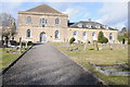
France Congregational Church and Hall
The former France Congregational Church and Hall at Chalford. My impression is that it has been converted into residential accommodation.
Image: © Philip Halling
Taken: 10 Mar 2012
0.18 miles
7
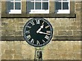
Clock, France Meeting, Chalford
The clock is on the south elevation of what is, or was, a meeting house shown in this image http://www.geograph.org.uk/photo/1020552 Unfortunately it is not working.
Image: © Brian Robert Marshall
Taken: 24 Oct 2008
0.18 miles
8
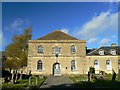
France Meeting, Chalford
France Meeting dates to the 17th century. The building here was rebuilt in 1819. More here about Protestant nonconformity locally http://www.british-history.ac.uk/report.aspx?compid=19022
Image: © Brian Robert Marshall
Taken: 24 Oct 2008
0.18 miles
9
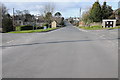
Middle Hill
Middle Hill at Chalford Hill.
Image: © Philip Halling
Taken: 10 Mar 2012
0.20 miles
10
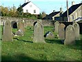
Graves, France Meeting, Chalford
The graves are south of the building seen here http://www.geograph.org.uk/photo/1020552 The view is to the east.
Image: © Brian Robert Marshall
Taken: 24 Oct 2008
0.20 miles