
IMAGES TAKEN NEAR TO
St. Marys, STROUD, GL6 8NX
Introduction
This page details the photographs taken nearby to St. Marys, GL6 8NX by members of the Geograph project.
The Geograph project started in 2005 with the aim of publishing, organising and preserving representative images for every square kilometre of Great Britain, Ireland and the Isle of Man.

There are currently over 7.5m images from over14,400 individuals and you can help contribute to the project by visiting https://www.geograph.org.uk
Image Map
Images are licensed for reuse under creativecommons.org/licenses/by-sa/2.0
Notes
- Clicking on the map will re-center to the selected point.
- The higher the marker number, the further away the image location is from the centre of the postcode.
Image Listing (78 Images Found)
Images are licensed for reuse under creativecommons.org/licenses/by-sa/2.0
Image
Details
Distance
1
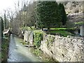
The River Frome at Chalford Bottom
Looking west [downstream]. Part of the river has been diverted into a millstream.
Image: © Christine Johnstone
Taken: 28 Mar 2016
0.02 miles
2
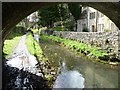
Thames & Severn Canal, below Iles Lock
Beautifully clear, but very shallow.
Image: © Christine Johnstone
Taken: 28 Mar 2016
0.02 miles
3
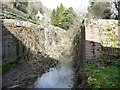
Iles Lock, Thames & Severn Canal, from the west
This lock has a rise of 8ft [2.4m].
Image: © Christine Johnstone
Taken: 28 Mar 2016
0.03 miles
4
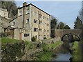
Clayfields Mill, Chalford
Clayfields Mill overlooking the Thames and Severn Canal at Chalford.
Image: © Philip Halling
Taken: 12 Mar 2016
0.03 miles
5
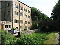
Beside the Thames and Severn Canal, Chalford
Looking upstream.
Image: © David Purchase
Taken: 21 Jun 2017
0.03 miles
6
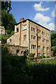
Clayfields Mill, Chalford
This is a Grade II listed former silk mill that is now a detached house. It is probably part late 17th century and was considerably rebuilt by the Thames & Severn Canal Company in c1785.
The disused canal is in the foreground.
Image: © Chris Allen
Taken: 27 May 2012
0.03 miles
7
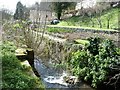
Iles Lock, Thames & Severn Canal, from the east
With the remains of one top gatepost. This lock has a rise of 8ft [2.4m].
Image: © Christine Johnstone
Taken: 28 Mar 2016
0.04 miles
8
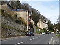
Four storey buildings on the A419, Chalford
Probably two storey at the back.
Image: © Christine Johnstone
Taken: 28 Mar 2016
0.07 miles
9
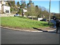
Site of Ballingers Lock
The Thames & Severn Canal and the main Stroud - Cirencester Road run side by side approaching Chalford. In 1967 some road widening and re-alignment took place over the abandoned canal. At this point a bridge has been demolished and Ballingers Lock has been buried under the patch of grass and the pre-fab garages.
Image: © David Stowell
Taken: 30 Jan 2008
0.07 miles
10
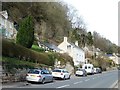
Taking advantage of steep sided valley, Chalford
Solar panels in a front garden, on the north side of London Road.
Image: © Christine Johnstone
Taken: 28 Mar 2016
0.07 miles