
IMAGES TAKEN NEAR TO
The Hawthorns, STROUD, GL6 8DQ
Introduction
This page details the photographs taken nearby to The Hawthorns, GL6 8DQ by members of the Geograph project.
The Geograph project started in 2005 with the aim of publishing, organising and preserving representative images for every square kilometre of Great Britain, Ireland and the Isle of Man.

There are currently over 7.5m images from over14,400 individuals and you can help contribute to the project by visiting https://www.geograph.org.uk
Image Map
Images are licensed for reuse under creativecommons.org/licenses/by-sa/2.0
Notes
- Clicking on the map will re-center to the selected point.
- The higher the marker number, the further away the image location is from the centre of the postcode.
Image Listing (10 Images Found)
Images are licensed for reuse under creativecommons.org/licenses/by-sa/2.0
Image
Details
Distance
1
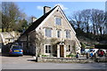
The Ram, Bussage
The Ram, public house in Bussage.
Image: © Philip Halling
Taken: 10 Mar 2012
0.10 miles
2
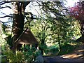
Bussage Hill, Bussage
Bussage Hill is a very narrow highway that leads down to the road to Brimscombe. At the left is the lych gate for the parish church seen here http://www.geograph.org.uk/photo/1020688
Image: © Brian Robert Marshall
Taken: 24 Oct 2008
0.14 miles
3
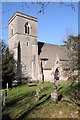
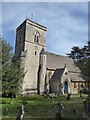
Bussage church
Bussage church is dedicated to St Michael and All Angels.
Image: © Philip Halling
Taken: 10 Mar 2012
0.16 miles
4
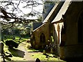
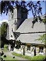
St Michael and All Angels, Bussage
This view is facing west and shows the southern part of the church and part of the churchyard. St Michael and All Angels is, despite appearances, not that old. The church was built in 1844 with additions in 1854. Listed Grade II http://www.imagesofengland.org.uk/Details/Default.aspx?id=132804
Image: © Brian Robert Marshall
Taken: 24 Oct 2008
0.16 miles
5
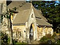
St Michael and All Angels, south elevation, Bussage
St Michael and All Angels is, despite appearances, not that old. The church was built in 1844 with additions in 1854. Listed Grade II http://www.imagesofengland.org.uk/Details/Default.aspx?id=132804
Image: © Brian Robert Marshall
Taken: 24 Oct 2008
0.16 miles
7
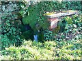
Spout, Bussage
The spring water from here flows to the sink seen in this image http://www.geograph.org.uk/photo/1020746
Image: © Brian Robert Marshall
Taken: 24 Oct 2008
0.19 miles
9
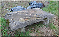
Stone Stile, out of place
From the NE corner of Frith Wood. This slab was a stone stile prior to 1979 when the houses nearby there were built. It was dug up by the developers and an enterprising 28-year-old saved it from the breakers' yard. Afterwards, he told the old guys in the pub and one reported "That was where I did my courting!". It is used as a seat in its saviour's garden to this day. See original location - Image
Image: © Mr Red
Taken: 16 Dec 2021
0.22 miles
10
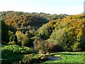
Toadsmoor, Bussage
The woodland beyond is within the square. In the foreground is a pond, sink, sump, tank or cistern, I can't decide which, fed from a spring.
Image: © Brian Robert Marshall
Taken: 24 Oct 2008
0.22 miles