
IMAGES TAKEN NEAR TO
Church Hill, STROUD, GL6 7RE
Introduction
This page details the photographs taken nearby to Church Hill, GL6 7RE by members of the Geograph project.
The Geograph project started in 2005 with the aim of publishing, organising and preserving representative images for every square kilometre of Great Britain, Ireland and the Isle of Man.

There are currently over 7.5m images from over14,400 individuals and you can help contribute to the project by visiting https://www.geograph.org.uk
Image Map
Images are licensed for reuse under creativecommons.org/licenses/by-sa/2.0
Notes
- Clicking on the map will re-center to the selected point.
- The higher the marker number, the further away the image location is from the centre of the postcode.
Image Listing (67 Images Found)
Images are licensed for reuse under creativecommons.org/licenses/by-sa/2.0
Image
Details
Distance
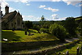
1

Sheepscombe: St John the Apostle
Image: © Christopher Hilton
Taken: 31 May 2011
0.03 miles
2
Sheepscombe: St John the Apostle
Image: © Christopher Hilton
Taken: 31 May 2011
0.03 miles
3
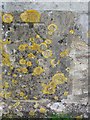
Bench Mark, St John's Church, Sheepscombe
The bench mark is to be found on the east side of the church. For a view of the church http://www.geograph.org.uk/photo/2031051 and for further information on the cut mark http://www.bench-marks.org.uk/bm35296
A bench mark is an Ordnance Survey arrowhead sign found on walls, bridges, churches and specially erected triangulation pillars where the altitude above sea-level has been accurately measured by surveyors. The arrowhead points to a horizontal line above it which marks the exact altitude.
With rivets and pivots there is no datum (horizontal line) cut, the pointed-to horizontal surface defining the datum height.
The wall is heavily covered in lichen.
Lichens do not have roots, but absorb water and gases through their upper surface, and are therefore sensitive to atmospheric pollution. For this reason they are rarely found around cities and grow best on the wetter west side of the British Isles. Those on trees thrive best on the sunny, south-west aspects of trunks and branches. Disappearance of lichen species can be used to detect rising levels of air pollution.
There are three main types. The encrusting forms, including the bright orange/dark yellow 'Xanthoria' grow on roofs, walls, gravestones, signs and tree trunks. Leaf-like species develop flat lobes spreading over bark or stones, and shrubby forms which grow vertically from the ground or hang from trees. Few have common names.
Image: © Maigheach-gheal
Taken: 9 Aug 2010
0.03 miles
4
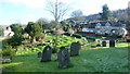
Sheepscombe viewed from St. John's churchyard
Looking east on a chilly February morning.
Image: © Jonathan Billinger
Taken: 11 Feb 2016
0.04 miles
5
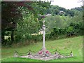
War Memorial, Sheepscombe
Lest we forget.
Image: © Maigheach-gheal
Taken: 9 Aug 2010
0.04 miles
6
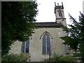
St John's Church, Sheepscombe
The church was built by John Wight in 1820 with further building taking place in 1872 by Francis Niblett. It is built of Limestone ashlar.
Image: © Maigheach-gheal
Taken: 9 Aug 2010
0.04 miles
7
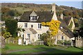
Cottage in Sheepscombe
A Cotswold-stone built cottage in the village of Sheepscombe.
Image: © Philip Halling
Taken: 31 Oct 2015
0.04 miles
8
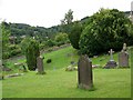
Churchyard, St John's Church
The churchyard is set on undulating ground and has many old gravestones within it.
Image: © Maigheach-gheal
Taken: 9 Aug 2010
0.05 miles
9
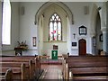
Interior, St John's Church
The pews are of pitch pine and the window was glazed in 1872.
Image: © Maigheach-gheal
Taken: 9 Aug 2010
0.05 miles
10
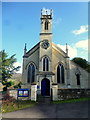
St. John's church, Sheepscombe
One of only a handful of Regency-era village churches in the country.
Image: © Jonathan Billinger
Taken: 11 Feb 2016
0.05 miles