
IMAGES TAKEN NEAR TO
Slad, STROUD, GL6 7QE
Introduction
This page details the photographs taken nearby to GL6 7QE by members of the Geograph project.
The Geograph project started in 2005 with the aim of publishing, organising and preserving representative images for every square kilometre of Great Britain, Ireland and the Isle of Man.

There are currently over 7.5m images from over14,400 individuals and you can help contribute to the project by visiting https://www.geograph.org.uk
Image Map
Images are licensed for reuse under creativecommons.org/licenses/by-sa/2.0
Notes
- Clicking on the map will re-center to the selected point.
- The higher the marker number, the further away the image location is from the centre of the postcode.
Image Listing (19 Images Found)
Images are licensed for reuse under creativecommons.org/licenses/by-sa/2.0
Image
Details
Distance
1
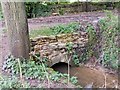
Bridge over Slad Brook
The Dillay joins the Slad just upstream and together they flow under this well-made little stone arch.
Image: © Mike White
Taken: 10 Sep 2008
0.07 miles
2
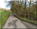
Slad: Steanbridge Lane passes a pond and a restricted byway
Alongside the pond, http://www.geograph.org.uk/photo/2788334 a sign pointing right shows Restricted Byway. In 2000 the legal term restricted byway was introduced for roads or tracks on which travel on foot, on a bicycle, by horse-drawn carriage etc is allowed, but not using a mechanically propelled vehicle.
Image: © Jaggery
Taken: 8 Jan 2012
0.07 miles
3
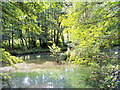
Steanbridge Mill Pond in Slad
This is the millpond mentioned in 'Cider with Rosie' by Laurie Lee.
Image: © Ian Hunter
Taken: 26 Jul 2006
0.12 miles
4
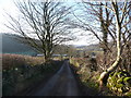
View down the Slad valley
Viewed from the lane near Down Farm.
Image: © Jeremy Bolwell
Taken: 3 Jan 2010
0.15 miles
5
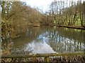
Pond between Steanbridge Court and Steanbridge Mill, Slad
The pond is alongside Steanbridge Lane in the Slad valley.
Image: © Jaggery
Taken: 8 Jan 2012
0.16 miles
6
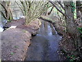
Slad Brook flows past a pond
Slad Brook, a tributary of the River Frome, flows towards the camera past the edge of a pond on the south side of Steanbridge Lane.
Image: © Jaggery
Taken: 8 Jan 2012
0.16 miles
7
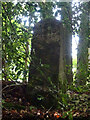
Milestone, Charles' Road
This alleged milestone is situated above a deep bridleway reputedly called Charles' Way by locals because the Royalist Army used it to reach Gloucester or Charles II used the route to escape to France.
Milestone Society National ID: GL_GLBI08
Image: © Mr Red
Taken: 29 Sep 2020
0.17 miles
8
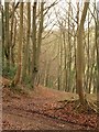
Redding Wood
Ahead, footpath MPA/141 descends diagionally across the steep woodland slope above the Slad valley. To right and left is a restricted byway.
Image: © Derek Harper
Taken: 2 Jan 2011
0.17 miles
10
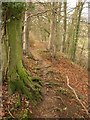
Path in Conigar
The path (footpath MPA/141) described in Image teeters above a precipitous drop through woodland into the Slad valley
Image: © Derek Harper
Taken: 2 Jan 2011
0.18 miles