
IMAGES TAKEN NEAR TO
The Taut, STROUD, GL6 7PA
Introduction
This page details the photographs taken nearby to The Taut, GL6 7PA by members of the Geograph project.
The Geograph project started in 2005 with the aim of publishing, organising and preserving representative images for every square kilometre of Great Britain, Ireland and the Isle of Man.

There are currently over 7.5m images from over14,400 individuals and you can help contribute to the project by visiting https://www.geograph.org.uk
Image Map
Images are licensed for reuse under creativecommons.org/licenses/by-sa/2.0
Notes
- Clicking on the map will re-center to the selected point.
- The higher the marker number, the further away the image location is from the centre of the postcode.
Image Listing (20 Images Found)
Images are licensed for reuse under creativecommons.org/licenses/by-sa/2.0
Image
Details
Distance
1

Spring comes to Oakridge in the Cotswolds
Lesser Celandines emerge beside Spring ploughsoil above Oakridge village.
Image: © Jeremy Bolwell
Taken: 28 Mar 2010
0.06 miles
2

Allotments, Oakridge
Look like nice sized plots here.
Image: © Jonathan Billinger
Taken: 11 Feb 2016
0.10 miles
3
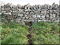
Stone Stile, Oakridge
A gap in a long wall left for animals to traverse. If this was not provided for animals like badgers, they would dig a tunnel for their own convenience, and destabalise a wall that had little or no foundation. The same applies to drainage.
Image: © Jayne Tovey
Taken: 7 Feb 2023
0.10 miles
4

Stone Stile, Oakridge
This stile is the remaining one after renovation of the wall. They were let in the wall for the players to retrieve their ball, when the playing field was used as a football pitch. It looks East to allotments from the playing fields, the view back is Image
Image: © Mr Red
Taken: 17 Feb 2022
0.11 miles
5

Stone Stile, Oakridge
This stile is the remaining one after renovation of the wall. They were let into the wall for the players to retrieve their ball, when the playing field was used as a football pitch. It looks West from allotments, the view East to the playing fields is Image
Image: © Mr Red
Taken: 17 Feb 2022
0.11 miles
6

Oakridge recreation ground
Facility on the east side of the village.
Image: © Jonathan Billinger
Taken: 11 Feb 2016
0.13 miles
7

Children's play area, Oakridge Lynch, Gloucestershire
In the southwest corner of the village cricket ground.
Image: © Jaggery
Taken: 19 Aug 2018
0.15 miles
8

Oakridge Lynch cricket pavilion, Gloucestershire
In the northeast corner of the village cricket ground.
Image: © Jaggery
Taken: 19 Aug 2018
0.17 miles
9
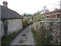
Lane into Oakridge
A Cotswold lane with dry stone walls, honey coloured walling and a view over Oakridge to a rookery.
Image: © Jeremy Bolwell
Taken: 28 Mar 2010
0.18 miles
10
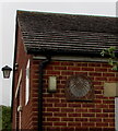
Sundial on a wall of Oakridge Village Hall, Oakridge Lynch, Gloucestershire
On the south-facing wall, behind the tree on the left here. https://www.geograph.org.uk/photo/5877758
Image: © Jaggery
Taken: 19 Aug 2018
0.20 miles