
IMAGES TAKEN NEAR TO
Edgeworth, STROUD, GL6 7JG
Introduction
This page details the photographs taken nearby to GL6 7JG by members of the Geograph project.
The Geograph project started in 2005 with the aim of publishing, organising and preserving representative images for every square kilometre of Great Britain, Ireland and the Isle of Man.

There are currently over 7.5m images from over14,400 individuals and you can help contribute to the project by visiting https://www.geograph.org.uk
Image Map
Images are licensed for reuse under creativecommons.org/licenses/by-sa/2.0
Notes
- Clicking on the map will re-center to the selected point.
- The higher the marker number, the further away the image location is from the centre of the postcode.
Image Listing (16 Images Found)
Images are licensed for reuse under creativecommons.org/licenses/by-sa/2.0
Image
Details
Distance
1
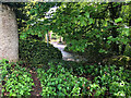
Stone Stile, Edgeworth
Off Ashletts Lane on Gloucestershire footpath BED21, looking South. The view North from the lane is Image
Image: © Jayne Tovey
Taken: 7 Nov 2022
0.02 miles
2
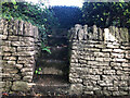
Stone Stile, Edgeworth
Off Ashletts Lane on Gloucestershire footpath BED21, looking North. The view South from the top is Image
Image: © Jayne Tovey
Taken: 7 Nov 2022
0.02 miles
4
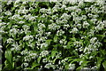
Ramsons or wild garlic in Edgeworth
Ramsons or wild garlic (Allium ursinum) growing on a roadside verge in the village of Edgeworth. Ramsons is also known as bear's garlic, as it was believed bears awakening from hibernation eat it to cleanse their metabolism and regain their strength, consequently the species name is derived from the Latin for bear.
Image: © Philip Halling
Taken: 3 May 2008
0.06 miles
5
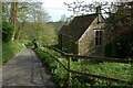
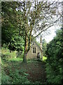
Old chapel? in Edgeworth
The architectural style of this building suggests it may have once been a chapel in the Cotswolds village of Edgeworth.
Image: © Philip Halling
Taken: 3 May 2008
0.08 miles
6
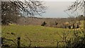
Pastures at Edgeworth
Looking from School Lane to the far hillside of the upper Frome valley.
Image: © Chris Brown
Taken: 6 Mar 2017
0.10 miles
7
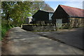
North Farm, Edgeworth
Farm buildings at North Farm in Edgeworth.
Image: © Philip Halling
Taken: 3 May 2008
0.15 miles
8
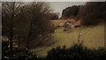
Edgeworth, the valley from the top of School Lane
School Lane connects the two clusters of Edgeworth through a steep combe.
Image: © Chris Brown
Taken: 6 Mar 2017
0.16 miles
9
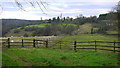
The Edgeworth valley
A small side valley of the Frome, a Cotswold stream that makes one of the five valleys of the Stroud towns.
Edgeworth parish church can be seen on the other side.
Image: © Jonathan Billinger
Taken: 6 Dec 2013
0.17 miles
10
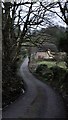
School Lane, Edgeworth
Looking north from close to the church and manor house end of the lane.
Image: © Chris Brown
Taken: 6 Mar 2017
0.18 miles