
IMAGES TAKEN NEAR TO
Bisley, STROUD, GL6 7BZ
Introduction
This page details the photographs taken nearby to GL6 7BZ by members of the Geograph project.
The Geograph project started in 2005 with the aim of publishing, organising and preserving representative images for every square kilometre of Great Britain, Ireland and the Isle of Man.

There are currently over 7.5m images from over14,400 individuals and you can help contribute to the project by visiting https://www.geograph.org.uk
Image Map
Images are licensed for reuse under creativecommons.org/licenses/by-sa/2.0
Notes
- Clicking on the map will re-center to the selected point.
- The higher the marker number, the further away the image location is from the centre of the postcode.
Image Listing (11 Images Found)
Images are licensed for reuse under creativecommons.org/licenses/by-sa/2.0
Image
Details
Distance
1
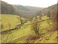
Dillay Brook valley
Partly covers the scene in Image; the short field boundary with trees dropping down to the Dillay Brook appear in both images. This is taken close to where footpath MPA/146/1 emerges from a slippery descent through Down Wood. Downstream, the valley quickly crosses into Image
Image: © Derek Harper
Taken: 2 Jan 2011
0.10 miles
2
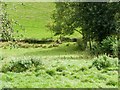
Footbridge over Dillay Brook
The bridge is sheep-proof. The path crosses over it on its way down the Dillay.
Image: © Mike White
Taken: 10 Sep 2008
0.11 miles
3
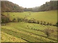
Dillay Brook valley
Looking up the valley, as it swings eastwards, from the same spot as Image A branch of the valley continues up to the left to Famish Hill.
Image: © Derek Harper
Taken: 2 Jan 2011
0.13 miles
4
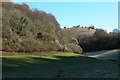
Nottingham Scrubs
This view is at the top end of the valley above the village of Slad.
Image: © Philip Halling
Taken: 29 Jan 2006
0.13 miles
5
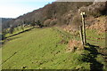
A junction of footpaths in the Slad valley
Image: © Philip Halling
Taken: 29 Jan 2006
0.14 miles
7
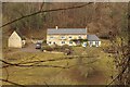
Dillay
A similar view to Image, looking across the Dillay Brook valley from footpath MBL/139/2.
Image: © Derek Harper
Taken: 2 Jan 2011
0.16 miles
8
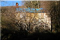
Derelict cottage in the Slad valley
Cottage in the top end of the Slad valley.
Image: © Philip Halling
Taken: 29 Jan 2006
0.18 miles
9
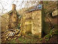
Timbercombe
The cottage in the Dillay Brook valley shown in Image is now, nearly five years on, a great deal more ruinous. Footpath MBL/138/2 passes beside it.
Image: © Derek Harper
Taken: 2 Jan 2011
0.18 miles
10
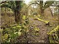
Path, Timbercombe
A mossy, rather broken-down wall just across a side valley from Image Footpath MBL/138/2, hemmed in on the other side by equally mossy tree trunks, is about to cross MBL/136 (right) and /143 (left).
Image: © Derek Harper
Taken: 2 Jan 2011
0.21 miles