
IMAGES TAKEN NEAR TO
Bisley, STROUD, GL6 7BX
Introduction
This page details the photographs taken nearby to GL6 7BX by members of the Geograph project.
The Geograph project started in 2005 with the aim of publishing, organising and preserving representative images for every square kilometre of Great Britain, Ireland and the Isle of Man.

There are currently over 7.5m images from over14,400 individuals and you can help contribute to the project by visiting https://www.geograph.org.uk
Image Map
Images are licensed for reuse under creativecommons.org/licenses/by-sa/2.0
Notes
- Clicking on the map will re-center to the selected point.
- The higher the marker number, the further away the image location is from the centre of the postcode.
Image Listing (5 Images Found)
Images are licensed for reuse under creativecommons.org/licenses/by-sa/2.0
Image
Details
Distance
1
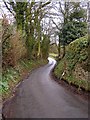
Country Lane
Just off the Birdlip to Bisley road, this lane is signposted for Througham.
Image: © Stuart Wilding
Taken: 11 Apr 2006
0.09 miles
2
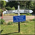
Old Direction Sign - Signpost by Holbrook Cottage, Calf Way
Ball finial - 3 arms; by the UC road, in parish of Bisley with Lypiatt (Stroud District), Calf Way.
To be surveyed
Milestone Society National ID: GL_SO9007
Image: © Milestone Society
Taken: Unknown
0.13 miles
3
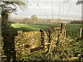
Stone Stile nr Lower Southmead Farm, Bisley GS1040
Stone Stile field to field Lower Southmead Farm, Bisley. On publis right or way MBL146 Separating fields near farm
Image: © Ian Roberts
Taken: 10 Jan 2021
0.14 miles
4
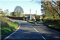
Holbrook Cottage
The main road is Calf Way.
Image: © Robin Webster
Taken: 13 Nov 2022
0.14 miles
5
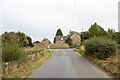
The Chequers
Vernacular farm building at The Chequers
Image: © P Gaskell
Taken: Unknown
0.24 miles