
IMAGES TAKEN NEAR TO
Van Der Breen Street, STROUD, GL6 7BW
Introduction
This page details the photographs taken nearby to Van Der Breen Street, GL6 7BW by members of the Geograph project.
The Geograph project started in 2005 with the aim of publishing, organising and preserving representative images for every square kilometre of Great Britain, Ireland and the Isle of Man.

There are currently over 7.5m images from over14,400 individuals and you can help contribute to the project by visiting https://www.geograph.org.uk
Image Map
Images are licensed for reuse under creativecommons.org/licenses/by-sa/2.0
Notes
- Clicking on the map will re-center to the selected point.
- The higher the marker number, the further away the image location is from the centre of the postcode.
Image Listing (61 Images Found)
Images are licensed for reuse under creativecommons.org/licenses/by-sa/2.0
Image
Details
Distance
1
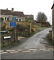
Van Der Breen Street, Bisley
Western end of a long dead-end street viewed from the High Street/Cheltenham Road junction.
A sign shows that Van Der Breen Street is unsuitable for heavy goods vehicles or wide vehicles.
Image: © Jaggery
Taken: 30 Dec 2018
0.10 miles
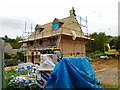
3
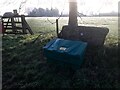
Stone Stile off Van Der Breen St., Bisley GS1039
Stone Slab Stile off road (Bisley to Water Lane) behind saltbin, Bisley. Stile is set-aside, now a kissing gate. MBL116 Leads off field behind Rectory Farm on Van Der Breen Street
Image: © Ian Roberts
Taken: 10 Jan 2021
0.12 miles
4
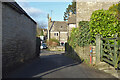
Narrow street, Bisley
Through traffic is directed this way to bypass the High Street, both are two-way and narrow.
Image: © Robin Webster
Taken: 9 Jan 2022
0.12 miles
5
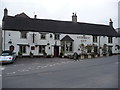
The Stirrup Cup public house, Bisley
Village pub.
Image: © Jeremy Bolwell
Taken: 28 Mar 2010
0.13 miles
6
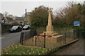
Bisley War Memorial
Located on the east side of Cheltenham Road near the Stirrup Cup. https://www.geograph.org.uk/photo/6011407
The Cotswold stone War Memorial was dedicated on April 3rd 1921.
Grade II listed in 2010.
Image: © Jaggery
Taken: 30 Dec 2018
0.13 miles
8
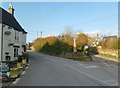
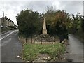
Bisley, war memorial
Opposite the Stirrup Cup; recording the names of 24 fallen in WWI & WWII.
Image: © Mike Faherty
Taken: 3 Feb 2012
0.13 miles
9
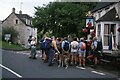
SRC Jubilee Walk 1953 - 2003 - Bisley, Gloucestershire
The year 2003 saw the 50th anniversary of the Stroud Rambling Club. This Club had sections for walkers, cyclists, climbers, cavers, canoeists and horse riders. Celebrations took place over the weekend of the 19th and 20th July. The Saturday saw members gathering at the Stirrup Cup pub (public house) in the village of Bisley, to the east-northeast of Stroud, for a circuit of the 9 mile George Watkins Memorial Walk. George was a founding member and a past Chairman of the Club, who along with many others worked to offer a full programme of events throughout the year. Time photo taken 9.15 am BST (British Summer Time).
Image: © Martin Richard Phelan
Taken: 19 Jul 2003
0.13 miles
10
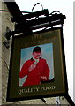
The Stirrup Cup name sign, Bisley
Hanging from a wall bracket here. https://www.geograph.org.uk/photo/6011407
Image: © Jaggery
Taken: 30 Dec 2018
0.13 miles