
IMAGES TAKEN NEAR TO
Edge Road, STROUD, GL6 6UW
Introduction
This page details the photographs taken nearby to Edge Road, GL6 6UW by members of the Geograph project.
The Geograph project started in 2005 with the aim of publishing, organising and preserving representative images for every square kilometre of Great Britain, Ireland and the Isle of Man.

There are currently over 7.5m images from over14,400 individuals and you can help contribute to the project by visiting https://www.geograph.org.uk
Image Map
Images are licensed for reuse under creativecommons.org/licenses/by-sa/2.0
Notes
- Clicking on the map will re-center to the selected point.
- The higher the marker number, the further away the image location is from the centre of the postcode.
Image Listing (274 Images Found)
Images are licensed for reuse under creativecommons.org/licenses/by-sa/2.0
Image
Details
Distance
1
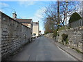
Edge Road, Painswick
The Cotswold Way, day three 10:21am
Image: © Ian S
Taken: 19 Apr 2013
0.02 miles
2
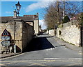
Single track road in Painswick
Edge Road heads WNW away from the A46.
Image: © Jaggery
Taken: 23 Mar 2014
0.03 miles

4
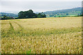
Barley field near Painswick
Looking in the direction of Stroud.
Image: © Bill Boaden
Taken: 17 Jul 2016
0.04 miles
5
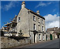
Wellington House, Painswick
Three storey house dating from c1800, alongside the A46 near the Edge Road junction.
Grade II listed in 1990.
Image: © Jaggery
Taken: 23 Mar 2014
0.05 miles
6
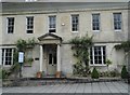
Georgian house on New Street, Painswick
Most of the houses along New Street are also Georgian
Image: © David Howard
Taken: 28 Jul 2018
0.05 miles
7
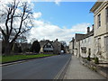
The A46, Painswick
The Cotswold Way, day three 10:20am
Image: © Ian S
Taken: 19 Apr 2013
0.05 miles
8

New Street houses in Painswick
Looking along the A46 New Street towards the Edge Road junction.
Image: © Jaggery
Taken: 23 Mar 2014
0.05 miles
9

The lych gate, St Mary's Church, Painswick
Image: © David Smith
Taken: 29 Dec 2017
0.05 miles
10

Lych gate, St Mary's Church Painswick
The half timbered lych gate was built in 1901 with timbers from the old belfry.
Many churches have a lych gate built over the main entrance to the enclosed area round the church. The name, also spelt lich or lytch, is from the Anglo Saxon 'lich' meaning corpse. The gate marks the division between consecrated and unconsecrated ground, where the bearers sheltered with the coffin, waiting for the clergyman to lead the procession before the burial. The original lych gates had seats, a lych cross and a lych stone - a slab on which the coffin rested.
Image: © Maigheach-gheal
Taken: 9 Aug 2010
0.05 miles