1
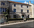
Beaconsfield House, Painswick
The 3-storey house was built in New Street in the early 19th century. Grade II listed in 1990.
Image: © Jaggery
Taken: 23 Mar 2014
0.00 miles
2
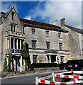
The Fiery Beacon and Beaconsfield House, Painswick
Viewed across New Street. In late March 2014, there is a For Sale board on the Fiery Beacon on the left.
The Fiery Beacon and Beaconsfield House are each Grade II listed.
Image: © Jaggery
Taken: 23 Mar 2014
0.00 miles
3
New Street, Painswick
Converging verticals perhaps exaggerate the steepness of this slope, but the pedestrians are clearly feeling it.
Image: © Derek Harper
Taken: 18 Sep 2008
0.01 miles
4
New Street
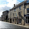
The A46 through the centre of Painswick. The building on the right of the photo is Beaconsfield House, next to it, with the gothic front, is The Fiery Beacon, then, with the balustraded parapet, Beacon House. The first two are grade II listed - see www.historicengland.org.uk/listing/the-list/list-entry/1340514 and www.historicengland.org.uk/listing/the-list/list-entry/1152605 respectively; Beacon House is grade I listed - see www.historicengland.org.uk/listing/the-list/list-entry/1152614.
Image: © Ian Capper
Taken: 6 Dec 2019
0.01 miles
5
Telephone box, Painswick
K6 type telephone box. The spire of St Mary's Church is in the background.
In 1935, the Post Office commissioned a new kiosk from Sir Giles Gilbert Scott to celebrate the Jubilee of King George V. The K6 Jubilee Kiosk, as it is known, was similar to the K2 box, being made of cast iron and painted red but was 25% lighter in weight. By the end of the 1930s there were 20,000 K6 telephone boxes in use all over the UK.
Image: © Maigheach-gheal
Taken: 9 Aug 2010
0.01 miles
6
Former Post Office in Painswick
When this was a Post Office it was the oldest one in the country. It is unusual to see a part timber-frame building in Painswick, a town where Cotswold stone is the dominate building material. Note the fire insure plaque on the front of the building
Image
Image: © Philip Halling
Taken: 5 Sep 2022
0.01 miles
7
New Street, Painswick
Looking SW along the A46 New Street towards the Victoria Street junction.
Image: © Jaggery
Taken: 23 Mar 2014
0.01 miles
8
New Street, Painswick
Image: © Roger Cornfoot
Taken: 29 Sep 2022
0.01 miles
9
Grade I listed Beacon House, Painswick
On the west side of New Street, opposite Victoria Street, the large 3-storey town house dates from 1766.
A nearby information board describes it as a Palladian mansion built of fine limestone ashlar,
formerly owned by the Wood-Mason family, wealthy local clothiers.
Beacon House was Grade I listed (the highest category) in 1955.
Image: © Jaggery
Taken: 23 Mar 2014
0.01 miles
10
The Falcon Inn, Painswick
Built in 1554 it served as a courthouse, as well as a licensed house from the 17th century. The Falcon became the leading coaching inn for Painswick and it has been the scene of cockfights and Masonic meetings.
Image: © Maigheach-gheal
Taken: 9 Aug 2010
0.01 miles


