
IMAGES TAKEN NEAR TO
Butt Green, STROUD, GL6 6QT
Introduction
This page details the photographs taken nearby to Butt Green, GL6 6QT by members of the Geograph project.
The Geograph project started in 2005 with the aim of publishing, organising and preserving representative images for every square kilometre of Great Britain, Ireland and the Isle of Man.

There are currently over 7.5m images from over14,400 individuals and you can help contribute to the project by visiting https://www.geograph.org.uk
Image Map
Images are licensed for reuse under creativecommons.org/licenses/by-sa/2.0
Notes
- Clicking on the map will re-center to the selected point.
- The higher the marker number, the further away the image location is from the centre of the postcode.
Image Listing (72 Images Found)
Images are licensed for reuse under creativecommons.org/licenses/by-sa/2.0
Image
Details
Distance
1

Autumn crocus, Painswick
Crocus nudiflorus growing beside the field path from Painswick towards Highfold Farm. As it is adjacent to the southern edge of the grounds of Painswick House, it may well be an escape.
Image: © Derek Harper
Taken: 19 Oct 2007
0.07 miles
2
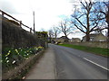
Gloucester Road, Painswick
The Cotswold Way, day three 10:05am
Image: © Ian S
Taken: 19 Apr 2013
0.09 miles
3
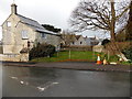
Pound House and a former pound, Painswick
Viewed across Gloucester Road. Pound House is next to a chained-off grassy area which used to be a pound where stray animals were kept until claimed by their owners.
Image: © Jaggery
Taken: 23 Mar 2014
0.09 miles
4
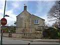
Toll House, Painswick
Pound House, so called because the green to the right was a pound for keeping stray animals in, until they could be collected. The house would have been the last house in the town at the time the Gloucester and Painswick Turnpike Trust was formed.
Milestone Society National ID: GL.PAI02
Image: © Mr Red
Taken: 11 Apr 2022
0.10 miles
5
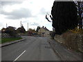
Gloucester Road, Painswick
The Cotswold Way, day three 10:05am
Image: © Ian S
Taken: 19 Apr 2013
0.10 miles
6
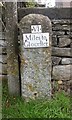
Old Milestone by the B4073, Gloucester Road, north of Painswick
Metal plate attached to stone post by the B4073, in parish of PAINSWICK (STROUD District), Gloucester Road, on the verge in front of wall of No.8, on East side of road. Glocester incised iron plate, erected by the Painswick turnpike trust in the 19th century.
Inscription reads:-
VI
Miles to
Gloceſter
Grade II Listed.
List Entry Number:1447095 https://historicengland.org.uk/listing/the-list/list-entry/1447095
Milestone Society National ID: GL_GLSDA06.
Image: © M Faherty
Taken: 3 Oct 2010
0.10 miles
7
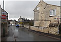
No entry to Gloucester Road Painswick
A one-way system is in force along this narrow part of the B4073.
Image: © Jaggery
Taken: 23 Mar 2014
0.10 miles
8
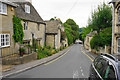
Gloucester Street, Painswick
All the roads in Painswick are narrow.
Image: © Bill Boaden
Taken: 23 Jul 2015
0.12 miles
9
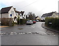
Canton Acre, Painswick
Cul-de-sac viewed across Pullens Road.
Image: © Jaggery
Taken: 23 Mar 2014
0.13 miles
10
Tempted, but we have to kept walking
The Cotswold Way, day three 10:07am
Image: © Ian S
Taken: 19 Apr 2013
0.14 miles