
IMAGES TAKEN NEAR TO
Randwick, STROUD, GL6 6JB
Introduction
This page details the photographs taken nearby to GL6 6JB by members of the Geograph project.
The Geograph project started in 2005 with the aim of publishing, organising and preserving representative images for every square kilometre of Great Britain, Ireland and the Isle of Man.

There are currently over 7.5m images from over14,400 individuals and you can help contribute to the project by visiting https://www.geograph.org.uk
Image Map
Images are licensed for reuse under creativecommons.org/licenses/by-sa/2.0
Notes
- Clicking on the map will re-center to the selected point.
- The higher the marker number, the further away the image location is from the centre of the postcode.
Image Listing (41 Images Found)
Images are licensed for reuse under creativecommons.org/licenses/by-sa/2.0
Image
Details
Distance
1
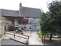
The Vine Tree Inn, Randwick
And time for a well earned pint or two. The Cotswold Way, day three 12:34pm
Image: © Ian S
Taken: 19 Apr 2013
0.02 miles
2
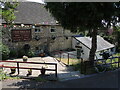
The Vine Tree Inn, Randwick
Having had recent change of landlords, the pub offers lots of fresh seafood and live music evenings.
Image: © Neil Owen
Taken: 8 Jun 2023
0.02 miles
3
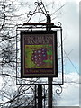
The Vine Tree Inn, Randwick
The Cotswold Way, day three 12:33pm
Image: © Ian S
Taken: 19 Apr 2013
0.03 miles
4
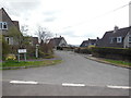
The Hill (road) in Randwick
The Cotswold Way, day three 12:32pm
Image: © Ian S
Taken: 19 Apr 2013
0.05 miles
5
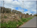
A path leading back to the Cotswold Way
The Cotswold Way, day three 1:38pm
Image: © Ian S
Taken: 19 Apr 2013
0.05 miles
6
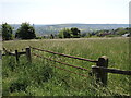
Path above Randwick
A footpath leaves Randwick and heads up the hill to Standish Wood, passing fields as it does so.
Image: © Neil Owen
Taken: 8 Jun 2023
0.06 miles
7
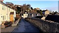
The Lane, Randwick
Looking towards Ocker Hill.
Image: © Jonathan Billinger
Taken: 3 Dec 2019
0.07 miles
8
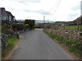
The village of Randwick
The Cotswold Way, day three 12:31pm
Image: © Ian S
Taken: 19 Apr 2013
0.08 miles
9
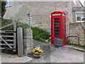
Ocker Hill phone box
An original red phonebox stands by the footpath marker at Ocker Hill, Randwick.
Image: © Vincent Jones
Taken: 29 Apr 2006
0.10 miles
10
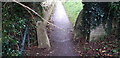
Stone Stile betwixt School and Church, Randwick GS9322
Stone squeeze stile on well-used footpath between Randwick School and Randwick Church. Public right of way MRA15. The squeeze gap is wide, possibly a central stone was standing between the two remaining stones and has been removed. Outer stones not aligned. May have been repositioned.
Image: © Bill Mesley
Taken: 7 Dec 2021
0.11 miles