
IMAGES TAKEN NEAR TO
Pinfarthings, STROUD, GL5 5JJ
Introduction
This page details the photographs taken nearby to Pinfarthings, GL5 5JJ by members of the Geograph project.
The Geograph project started in 2005 with the aim of publishing, organising and preserving representative images for every square kilometre of Great Britain, Ireland and the Isle of Man.

There are currently over 7.5m images from over14,400 individuals and you can help contribute to the project by visiting https://www.geograph.org.uk
Image Map
Images are licensed for reuse under creativecommons.org/licenses/by-sa/2.0
Notes
- Clicking on the map will re-center to the selected point.
- The higher the marker number, the further away the image location is from the centre of the postcode.
Image Listing (25 Images Found)
Images are licensed for reuse under creativecommons.org/licenses/by-sa/2.0
Image
Details
Distance
1

Pinfarthings: postbox № GL5 28
This George-VI postbox is currently missing its information plate.
Image: © Chris Downer
Taken: 13 Nov 2012
0.04 miles
2
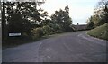
Lane junction - Pinfarthings, Gloucestershire
A lane junction at Pinfarthings in the Gloucestershire Cotswolds, between Stroud and Nailsworth. Above to the east, right in the photo, lies the National Trust managed expanse of Minchinhampton Common along with its more northerly companion Rodborough Common. During the summer months cattle roam free on these areas, which ought to be common knowledge, but it seems not as there have been accidents over the years. To the west, left in the photo, down below lies the A46 road through the Nailsworth Valley. This is also the route of a cyclepath based on the route of the Dudbridge Donkey, a railway line between Nailsworth and Stonehouse. Time photo taken not available.
Image: © Martin Richard Phelan
Taken: Unknown
0.05 miles
3
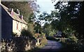
Cottage on the lane - Pinfarthings, Gloucestershire
A lane at Pinfarthings, which place sits below Minchinhampton Common to the east and above the A46 road and the Nailsworth Valley to the west. This photo was taken while I was house sitting for friends here for two weeks while they were in Hungary. It was no trouble at all to walk downhill to Nailsworth for shopping although it might be a little wearisome if I had to do it as a regular thing. But I did enjoy my stay - a Jaguar lifestyle on a pedal car income. Sitting here writing this on Boxing Day 2020 in Birmingham I remember those Gloucestershire days although the memories I have of them are very bittersweet. Long walks, lost love, much unemployment, little money, renting all rear their heads leaving me wishing I had looked after my own direction and welfare. Time lost can never be retrieved. Time photo taken not available.
Image: © Martin Richard Phelan
Taken: Unknown
0.06 miles

5
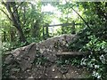
Stone Stile, Pinfarthing
On the SW fringes of Minchinhampton Common. NE of Watledge on Gloucestershire footpath MMH172.
Looking North from Whips Lane (track). Alternative views with ivy removed reveals a much wider stile,
view North of this is Image,
and the view looking to the lane is Image
Image: © Ian Kenny Roberts
Taken: 17 May 2022
0.08 miles
6
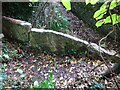
Stone Stile, Whips Lane, Pinfarthing
On the SW fringes of Minchinhampton Common. NE of Watledge on Gloucestershire footpath MMH172.
Looking SE onto the track that is called Whips Lane, with ivy removed revealing a very wide stile.
The view North is https://www.geograph.org.uk/photo/7323360 and with ivy https://www.geograph.org.uk/photo/7174864 .
Image: © Mr Red
Taken: 25 Oct 2022
0.08 miles
7
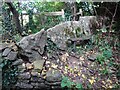
Stone Stile, Whips Lane, Pinfarthing
OnOn the SW fringes of Minchinhampton Common. NE of Watledge on Gloucestershire footpath MMH172.
Looking North from the track that is called Whips Lane, with ivy removed revealing a very wide stile.
The view SE is Image
Image: © Mr Red
Taken: 25 Oct 2022
0.08 miles
8
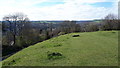
View from the edge of Minchinhampton Common
Image: © Vieve Forward
Taken: 6 Apr 2019
0.09 miles
9
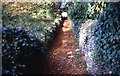
Rising to Minchinhampton Common - Pinfarthings, Gloucestershire
To the north-east of Watledge in the Nailsworth Valley this enclosed path leads up to a roadway on the south-western edge of Minchinhampton Common. The origins of this drystone wall enclosed path with its solidly built archway at the top are unknown to me at the moment. Time photo taken not available. Image] Image]
Image: © Martin Richard Phelan
Taken: Unknown
0.10 miles
10
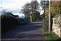
Lane at Pinfarthings - Amberley, Gloucestershire
A lane, looking northwards, at Pinfarthings in the Gloucestershire Cotswolds, between Stroud and Nailsworth. Above to the east, right in the photo, lies the National Trust managed expanse of Minchinhampton Common along with its more northerly companion Rodborough Common. During the summer months cattle roam free on these areas, which ought to be common knowledge, but it seems not as there have been accidents over the years. To the west, left in the photo, down below lies the A46 road through the Nailsworth Valley. This also parallels the route of a cyclepath based on the route of the Dudbridge Donkey, a one time train on the now disused railway line between Nailsworth and Stonehouse. Time photo taken not available.
Image: © Martin Richard Phelan
Taken: Unknown
0.10 miles