
IMAGES TAKEN NEAR TO
Park Lane, STROUD, GL5 5HW
Introduction
This page details the photographs taken nearby to Park Lane, GL5 5HW by members of the Geograph project.
The Geograph project started in 2005 with the aim of publishing, organising and preserving representative images for every square kilometre of Great Britain, Ireland and the Isle of Man.

There are currently over 7.5m images from over14,400 individuals and you can help contribute to the project by visiting https://www.geograph.org.uk
Image Map
Images are licensed for reuse under creativecommons.org/licenses/by-sa/2.0
Notes
- Clicking on the map will re-center to the selected point.
- The higher the marker number, the further away the image location is from the centre of the postcode.
Image Listing (79 Images Found)
Images are licensed for reuse under creativecommons.org/licenses/by-sa/2.0
Image
Details
Distance
1
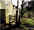
Park Lane stile, Inchbrook
Giving access to a track on the southeast side of Park Lane. Viewed in December 2015.
A notice on the post tells public footpath users that the gate will be locked from March 9th 2015
to allow grazing of the land. Please use the stile or adjacent kissing gate.
A Gloucestershire County Council notice states
PLEASE KEEP YOUR DOG UNDER CONTROL AND STAY ON THE PATH.
Thank you.
Image: © Jaggery
Taken: 20 Dec 2015
0.01 miles
2
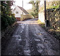
Muddy surface, Park Lane, Inchbrook
Viewed in December 2015.
Image: © Jaggery
Taken: 20 Dec 2015
0.02 miles
3
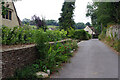
Park Lane, Inchbrook
Park Lane leads off St Mary's Hill on the slopes of the Woodchester Valley. It gives access to some residential properties but is a dead end for motor traffic.
Image: © Stephen McKay
Taken: 28 Jul 2022
0.02 miles
4
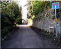
Park Lane, Inchbrook
Dead-end lane on the southwest side of the crossroads with Cow Lane, Convent Lane and St Mary's Hill.
Image: © Jaggery
Taken: 20 Dec 2015
0.02 miles
5
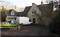
Park Lane house, Inchbrook
On the corner of Cow Lane.
Image: © Jaggery
Taken: 20 Dec 2015
0.02 miles
6
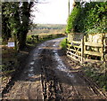
Private drive ahead - no access, Park Lane, Inchbrook
Viewed from the public part of Park Lane. The notice on the left shows
"Please do not park here today as wide vehicle access is needed".
Image: © Jaggery
Taken: 20 Dec 2015
0.02 miles
7
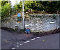
Grit tub on an Inchbrook corner
On the corner of Park Lane and Convent Lane. An arrow showing PARTY points left along Park Lane.
Image: © Jaggery
Taken: 20 Dec 2015
0.04 miles
8
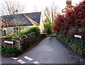
Cow Lane, Inchbrook
Cow Lane descends from the corner of St Mary's Hill.
Image: © Jaggery
Taken: 20 Dec 2015
0.04 miles
9
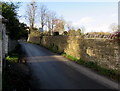
Western end of St Mary's Hill, Inchbrook
Looking towards the crossroads at the junctions of Cow Lane, Park Lane and Convent Lane.
Image: © Jaggery
Taken: 20 Dec 2015
0.04 miles
10
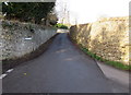
Convent Lane, Inchbrook
Ascending from the crossroads with Cow Lane, Park Lane and St Mary's Hill.
Image: © Jaggery
Taken: 20 Dec 2015
0.05 miles