1
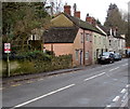
Dunkirk Mill
Image: © don cload
Taken: 13 May 2018
0.01 miles
2
Dunkirk Mills
Dunkirk Mills in Nailsworth, this building closed as a mill many years ago, and today it has been converted into residential apartments. However, there is a museum in the ground floor.
Image: © Philip Halling
Taken: 4 Aug 2018
0.01 miles
3
Dunkirk Mills
Former woollen mill in the Nailsworth valley.
Image: © Jonathan Billinger
Taken: 10 Mar 2020
0.02 miles
4
Old Counting House, Dunkirk Mills, Nailsworth
The name on the single-storey building is The Old Counting House,
part of the former Dunkirk Mills, converted to residential use.
Image: © Jaggery
Taken: 20 Dec 2015
0.02 miles
5
Entrance road to Dunkirk Mills, Nailsworth
From the east side of the A46 Stroud Road, the road crosses a bridge over Nailsworth Stream.
The former textile mills have been converted to residential use.
Image: © Jaggery
Taken: 20 Dec 2015
0.03 miles
6
Pipes over Nailsworth Stream, Nailsworth
Viewed from the Renishaw south entrance road. http://www.geograph.org.uk/photo/4792869 The stream is a tributary of the (Gloucestershire) River Frome, into which it flows at Dudbridge. The A46 Stroud Road is on the right.
Image: © Jaggery
Taken: 20 Dec 2015
0.04 miles
7
Stroud Road electricity substation, Nailsworth
The Western Power Distribution electricity substation is inside a brick building alongside the A46 Stroud Road.
A bus stop sign is on a pole at the edge of the substation.
Image: © Jaggery
Taken: 20 Dec 2015
0.04 miles
8
Dunkirk Mills
Former woollen cloth mill, now housing. Various date stones indicate 1798, 1818, 1827 and 1855. Had a Boulton & Watt beam engine supplied in 1820. Still retains several waterwheels and a little museum area. The visit was on a Heritage Open Day but the museum had closed by then - doing far too much as usual.
Image: © Chris Allen
Taken: 8 Sep 2001
0.04 miles
9
Queues likely at peak times, Stroud Road, Nailsworth
The sign faces northbound traffic on the A46 Stroud Road.
Image: © Jaggery
Taken: 20 Dec 2015
0.05 miles
10
Check your speed, Stroud Road, Nailsworth
The notice on a pole on the left reminds drivers that the speed limit on this part of the A46 is 40mph.
Image: © Jaggery
Taken: 20 Dec 2015
0.05 miles


