
IMAGES TAKEN NEAR TO
Rodborough Common, STROUD, GL5 5BX
Introduction
This page details the photographs taken nearby to GL5 5BX by members of the Geograph project.
The Geograph project started in 2005 with the aim of publishing, organising and preserving representative images for every square kilometre of Great Britain, Ireland and the Isle of Man.

There are currently over 7.5m images from over14,400 individuals and you can help contribute to the project by visiting https://www.geograph.org.uk
Image Map
Images are licensed for reuse under creativecommons.org/licenses/by-sa/2.0
Notes
- Clicking on the map will re-center to the selected point.
- The higher the marker number, the further away the image location is from the centre of the postcode.
Image Listing (25 Images Found)
Images are licensed for reuse under creativecommons.org/licenses/by-sa/2.0
Image
Details
Distance
1
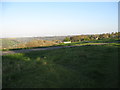
Evening sunshine on Rodborough - Stroud, Gloucestershire
Taken from Rodborough Common with the Golden Valley just out of sight beyond. The Common is a 287 acre Site of Special Scientific Interest, designated in 1954 with a variety of plantlife. It is also the scene of the annual grazing of cattle, something which motorists travelling in the area need to be aware of. Administered by the National Trust, there is plenty of parking, a number of self-guided walks but no formal picnic facilities. Time taken 6.45 pm BST (British Summer Time).
Image: © Martin Richard Phelan
Taken: 16 Apr 2014
0.01 miles
2
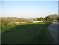
To Rodborough's frozen delights - Stroud, Gloucestershire
On the way to Rodborough's frozen delights, namely Winstone's Ice Cream Factory. This company started in the ice cream business in 1925 when Albert Winstone started making ice cream in his kitchen and from those origins has come a thriving business, run from the cluster of buildings on the right in this photo. Time taken 6.49 pm BST (British Summer Time).
Image
Image: © Martin Richard Phelan
Taken: 16 Apr 2014
0.01 miles
3
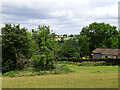
View east towards Bagpath near Stroud
At right is part of the well-known Winstone's Cotswold Ice Cream factory and retail outlet.
Image: © Brian Robert Marshall
Taken: 6 Jul 2023
0.04 miles
4
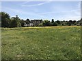
Edge of Minchinhampton Common near Bagpath
Image: © don cload
Taken: 17 May 2018
0.05 miles
5
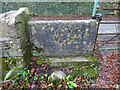
Stone Stile, Rodborough
In the Bagpath area, just SW of Winstones Ice Cream. The steep track leads NE to Bagpath Lane. This is looking out to the u/c road, the view looking to track is Image
Image: © Mr Red
Taken: 17 Dec 2021
0.06 miles
6
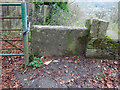
Stone Stile, Rodborough
In the Bagpath area, just SW of Winstones Ice Cream. The steep track leads NE to Bagpath Lane. The view looking out is Image
Image: © Mr Red
Taken: 17 Dec 2021
0.06 miles
7
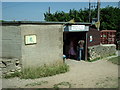
Winstones Ice Cream Factory, Rodborough Common
Purveyors of fine Cotswold Ice Cream
Image: © Angus Townley
Taken: 16 Jul 2005
0.08 miles
9
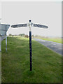
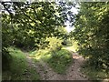
Direction Sign ? Signpost
Located in the centre of the junction between Rodborough Hill and Butterow Hill in Rodborough parish. Repaired with 2 arms again, and cap finial, compared to https://www.geograph.org.uk/photo/6516705.
Milestone Society National ID: GL_SO8502
Image: © Mr Red
Taken: Unknown
0.11 miles
10
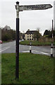
Direction Sign ? Signpost
Located in the centre of the junction between Rodborough Hill and Butterow Hill in Rodborough parish. 2 arms and cap finial.
Milestone Society National ID: GL_SO8502
Image: © Mr Red
Taken: 31 Jan 2020
0.11 miles