IMAGES TAKEN NEAR TO
The Leasows, Blind Lane, CHIPPING CAMPDEN, GL55 6ES
Introduction
This page details the photographs taken nearby to The Leasows, Blind Lane, GL55 6ES by members of the Geograph project.
The Geograph project started in 2005 with the aim of publishing, organising and preserving representative images for every square kilometre of Great Britain, Ireland and the Isle of Man.

There are currently over 7.5m images from over14,400 individuals and you can help contribute to the project by visiting https://www.geograph.org.uk
Image Map
Images are licensed for reuse under creativecommons.org/licenses/by-sa/2.0
Notes
- Clicking on the map will re-center to the selected point.
- The higher the marker number, the further away the image location is from the centre of the postcode.
Image Listing (84 Images Found)
Images are licensed for reuse under creativecommons.org/licenses/by-sa/2.0
Image
Details
Distance
1
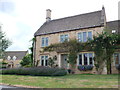
House on Blind Lane
Blind Lane is in Westfields on the western edge of the town where a number of new houses such as this one have been built.
Image: © Nigel Mykura
Taken: 5 Aug 2013
0.03 miles
2
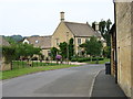
Blind Lane, Chipping Campden
If you drive along this lane, you can understand why it is called 'blind'. There is a narrow gap between two former farm buildings on a double bend ahead.
Image: © David Purchase
Taken: 18 Jun 2013
0.04 miles
3
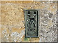
Ordnance Survey Flush Bracket 1762
This bracket can be found on the roadside wall of a building in Blind Lane, Westington. The benchmark height is recorded as being 155.095 metres above sea level. For more detail see : http://www.bench-marks.org.uk/bm10275
Image: © Peter Wood
Taken: 6 Nov 2017
0.04 miles
4
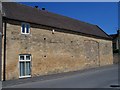
Carters Barn
This converted barn in Blind Lane, Chipping Campden seems to have seen a lot of changes.
Image: © Michael Dibb
Taken: 17 Jun 2010
0.04 miles
5
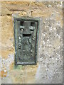
Ordnance Survey Flush Bracket (1762)
This OS Flush Bracket can be found on the SW face of a barn at Westington. It marks a point 155.0902m above mean sea level.
Image: © Adrian Dust
Taken: 27 Jun 2015
0.05 miles
6
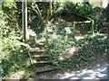
Footpath leaves road
This short footpath starts here and runs into the large field at the rear of the properties which has somehow escaped development.
Image: © Michael Dibb
Taken: 17 Jun 2010
0.05 miles
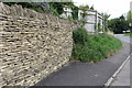
8
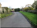
Blind Lane in Westington joining B4018
Looking south-eastward.
Image: © Peter Wood
Taken: 6 Nov 2017
0.07 miles
9
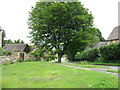
The approach to Chipping Campden
This is the B4081, just as it enters the town after descending Conduit Hill.
Image: © David Purchase
Taken: 18 Jun 2013
0.07 miles