1
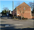
Corner of Westward Road and Monkey Puzzle Close, Ebley
Turn right for Monkey Puzzle Close.
Image: © Jaggery
Taken: 15 Jan 2012
0.00 miles
2
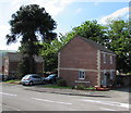
Monkey Puzzle Close, Ebley
Viewed from the Westward Road end. In view are some of the eight houses in the close. On the right is the bottom of the tree which gave the close its name. Araucaria araucana, the monkey puzzle tree, is an evergreen that can grow to 40 metres (130 ft) tall with a 2 metre (nearly 7 ft) trunk diameter. This one has not yet reached such dimensions.
Image: © Jaggery
Taken: 15 Jan 2012
0.02 miles
3
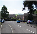
Monkey Puzzle Close, Ebley, Stroud
Monkey Puzzle Close is a cul-de-sac on the south side of Westward Road.
The tree in view which gives the close its name is Araucaria araucana, the monkey puzzle tree, an evergreen.
Image: © Jaggery
Taken: 7 May 2017
0.03 miles
4
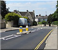
Monkey Puzzle Close, Ebley, Stroud
Monkey Puzzle Close is a cul-de-sac on the south side of Westward Road. On the right, the tree which gives the close its name is Araucaria araucana, the monkey puzzle tree, an evergreen.
Image: © Jaggery
Taken: 7 May 2017
0.03 miles
5
Westward Road bus stop and shelter, Ebley, Stroud
This side of the road for buses to Stroud town centre.
Image: © Jaggery
Taken: 7 May 2017
0.03 miles
6
Cotswold House Care Home, Cainscross near Stroud
On the corner of Westward Road and Church Road.
Image: © Jaggery
Taken: 15 Jan 2012
0.05 miles
7
Ebley Mill, Stroud
Ebley Mill, which is the headquarters of Stroud District Council, shot from the canal towpath.
Image: © Roger May
Taken: 20 Nov 2006
0.06 miles
8
Pedestrian refuge in Westward Road, Stroud
The refuge lets walkers cross half a road width at a time when traffic is busy on the B4008 Westward Road.
Image: © Jaggery
Taken: 7 May 2017
0.07 miles
9
Westward Road houses, Ebley
Houses on the north side of the road, west of Church Road.
Image: © Jaggery
Taken: 15 Jan 2012
0.07 miles
10
Scarlet House Care Home, Stroud
On the south side of the B4008 Westward Road, west of the Frome Gardens junction.
Image: © Jaggery
Taken: 7 May 2017
0.07 miles


