
IMAGES TAKEN NEAR TO
Hawthorn Rise, STROUD, GL5 4QW
Introduction
This page details the photographs taken nearby to Hawthorn Rise, GL5 4QW by members of the Geograph project.
The Geograph project started in 2005 with the aim of publishing, organising and preserving representative images for every square kilometre of Great Britain, Ireland and the Isle of Man.

There are currently over 7.5m images from over14,400 individuals and you can help contribute to the project by visiting https://www.geograph.org.uk
Image Map
Images are licensed for reuse under creativecommons.org/licenses/by-sa/2.0
Notes
- Clicking on the map will re-center to the selected point.
- The higher the marker number, the further away the image location is from the centre of the postcode.
Image Listing (31 Images Found)
Images are licensed for reuse under creativecommons.org/licenses/by-sa/2.0
Image
Details
Distance
1
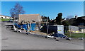
Building site on the corner of Westrip Place and The Martins, Stroud
Viewed in February 2013.
Image: © Jaggery
Taken: 17 Feb 2013
0.08 miles
2
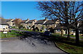
South side of The Martins, Stroud
The Martins is a roughly triangular area of houses in the NW of Stroud.
The name sign on the left shows THE MARTINS LEADING TO THE UPPER TYNINGS.
Image: © Jaggery
Taken: 17 Feb 2013
0.09 miles
3
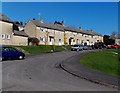
NW side of The Martins, Stroud
The Martins is a roughly triangular area of houses in the NW of Stroud.
Image: © Jaggery
Taken: 17 Feb 2013
0.09 miles
4
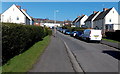
The Wordens, Stroud
A 125-metre long cul-de-sac viewed from the Foxmoor Lane end
looking towards the turning circle at the far end of The Wordens.
Image: © Jaggery
Taken: 17 Feb 2013
0.11 miles
5
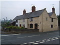
Cottages in Cashes Green
Cottages at the corner of Westrip Lane and Cashes Green Road, in an area where the majority of houses are modern.
Image: © Derek Harper
Taken: 5 Jul 2006
0.12 miles
6
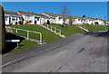
Westrip Place bungalows, Stroud
Viewed from the corner of The Martins.
Image: © Jaggery
Taken: 17 Feb 2013
0.12 miles
7
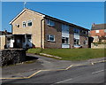
Henley Court flats, Stroud
Viewed across Cashes Green Road. The 4 flats are opposite Cashes Green Primary School. http://www.geograph.org.uk/photo/3814398
Image: © Jaggery
Taken: 17 Feb 2013
0.13 miles
8
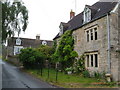
Redhouse Lane, Westrip
Westrip, on the edge of the built-up area of Stroud, retains a village feel. This photo, looking up the lane, shows Westrip Farm House and Westrip Lodge.
Image: © Derek Harper
Taken: 5 Jul 2006
0.13 miles
9
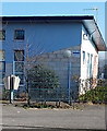
Coronation seat, Randwick
Located in front of Five Ways Children's Centre http://www.geograph.org.uk/photo/3814389 near the Randwick village boundary sign.
The plaque on the bench shows
CORONATION SEAT DONATED BY PARISHIONERS OF RANDWICK 1952 RESTORED - JUBILEE YEAR 1977.
Image: © Jaggery
Taken: 17 Feb 2013
0.14 miles
10
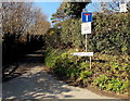
Signs at the SE end of Sandpits Lane, Westrip
On a pole above the street name sign is an improvised 20 is plenty sign (the actual speed limit here is 30mph) and a no through road sign. In the top right corner is a notice showing
This is a NEIGHBOURHOOD WATCH Area.
Image: © Jaggery
Taken: 17 Feb 2013
0.14 miles