
IMAGES TAKEN NEAR TO
Paganhill, STROUD, GL5 4BG
Introduction
This page details the photographs taken nearby to GL5 4BG by members of the Geograph project.
The Geograph project started in 2005 with the aim of publishing, organising and preserving representative images for every square kilometre of Great Britain, Ireland and the Isle of Man.

There are currently over 7.5m images from over14,400 individuals and you can help contribute to the project by visiting https://www.geograph.org.uk
Image Map
Images are licensed for reuse under creativecommons.org/licenses/by-sa/2.0
Notes
- Clicking on the map will re-center to the selected point.
- The higher the marker number, the further away the image location is from the centre of the postcode.
Image Listing (20 Images Found)
Images are licensed for reuse under creativecommons.org/licenses/by-sa/2.0
Image
Details
Distance
1
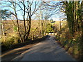
Ruscombe Road approaches Ruscombe Brook, Stroud
Ruscombe Brook flows under Ruscombe Road at the bend ahead.
Image: © Jaggery
Taken: 15 Jan 2012
0.02 miles
2
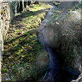
Ruscombe Brook, Stroud
Viewed from Ruscombe Road.
Image: © Jaggery
Taken: 15 Jan 2012
0.02 miles
3
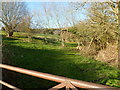
Trees in a Ruscombe Road field, Stroud
Trees viewed in their mid-January nakedness.
Image: © Jaggery
Taken: 15 Jan 2012
0.03 miles
4
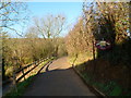
Private road and public bridleway to Folly Park Farm, Stroud
Viewed from the corner of Ruscombe Road.
Image: © Jaggery
Taken: 15 Jan 2012
0.04 miles
5
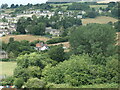
Humphries End
Looking westwards across the northern edge of Stroud.
Image: © Christine Johnstone
Taken: 15 Jul 2022
0.04 miles
6
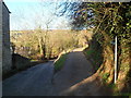
Fork in Ruscombe Road, Stroud
Ruscombe Road on the left, a public bridleway on the right.
Image: © Jaggery
Taken: 15 Jan 2012
0.05 miles
7
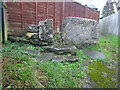
Stone Stile, Cashes Green
Is it a squeeze stile? Or a slab stile? Looking NW towards Elm Road on the Gloucestershire footpath MCA25. The view looking South is Image
Image: © Mr Red
Taken: 30 Dec 2021
0.13 miles
8
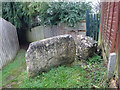
Stone Stile, Cashes Green
Is it a squeeze stile? Or a slab stile? Looking Southerly with Elm Road to the rear, on the Gloucestershire footpath MCA25. The view looking NW is Image
Image: © Mr Red
Taken: 30 Dec 2021
0.13 miles
9
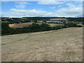
The valley of Ruscombe Brook
In the Cotswolds AONB, just north of Stroud.
Image: © Christine Johnstone
Taken: 15 Jul 2022
0.22 miles
10
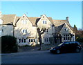
The Old Crown, Stroud
The Old Crown is a grade II listed Cotswold stone pub in Park End, Paganhill.
Image: © Jaggery
Taken: 15 Jan 2012
0.22 miles