
IMAGES TAKEN NEAR TO
Langley Road, CHELTENHAM, GL54 5QP
Introduction
This page details the photographs taken nearby to Langley Road, GL54 5QP by members of the Geograph project.
The Geograph project started in 2005 with the aim of publishing, organising and preserving representative images for every square kilometre of Great Britain, Ireland and the Isle of Man.

There are currently over 7.5m images from over14,400 individuals and you can help contribute to the project by visiting https://www.geograph.org.uk
Image Map
Images are licensed for reuse under creativecommons.org/licenses/by-sa/2.0
Notes
- Clicking on the map will re-center to the selected point.
- The higher the marker number, the further away the image location is from the centre of the postcode.
Image Listing (80 Images Found)
Images are licensed for reuse under creativecommons.org/licenses/by-sa/2.0
Image
Details
Distance
1
![The view from the hill [1]](https://s3.geograph.org.uk/geophotos/02/52/50/2525039_57929b7b_120x120.jpg)
The view from the hill [1]
As the Gloucestershire Way long distance path ascends Langley Hill, the views open up. This view shows part of Winchcombe at bottom of the hill. Corndean Hill is on the right whilst in the distance, the land rises to Roel Hill.
Image: © Michael Dibb
Taken: 10 Jul 2011
0.07 miles
2
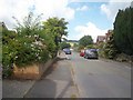
Harvey's Lane
From the main road in Winchcombe, the Gloucestershire Way long distance path ascends Langley Hill, initially by way of Harvey's Lane.
Image: © Michael Dibb
Taken: 10 Jul 2011
0.09 miles
3
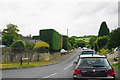
Harveys Lane, Winchcombe
A residential no through road by which the Winchcombe Way and Gloucestershire Way leave Winchcombe.
Image: © Bill Boaden
Taken: 20 Jul 2015
0.09 miles
4

View east along Langley Road
Looking towards Winchcombe with Salter's Hill in the background.
Image: © Jonathan Billinger
Taken: 11 Jun 2008
0.11 miles
5

Harvey's Lane
Road junction in Winchcombe.
Image: © Wayland Smith
Taken: 25 Apr 2021
0.11 miles
6
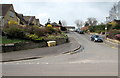
Tobacco Close, Winchcombe
Viewed across the B4632 Cheltenham Road.
I was surprised to learn that tobacco can be grown in the British climate. One online source states that in 1619, a London merchant, John Stratford, bought land in and around Winchcombe and planted tobacco. In the same year, Parliament passed an Act banning tobacco growing in England, just as the first crop in Winchcombe was ready to harvest.
Thereafter, though much of the land was turned to growing flax, illegal tobacco growing continued on a substantial scale, including fourteen plantations in Worcestershire. In Winchcombe the parish tithe barn was used to dry the leaves, and houses in North Street stored the cured tobacco. Soldiers were sent to Winchcombe on at least one occasion to destroy the illegal crop.
The exact location of the tobacco fields in Winchcombe is now uncertain. The area near Tobacco Close in the south of Winchcombe was formerly known as Tobacco Piece.
Image: © Jaggery
Taken: 5 Apr 2015
0.12 miles
7
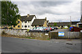
Langley Close, Winchcombe
A scheme of supported social housing.
Image: © Bill Boaden
Taken: 20 Jul 2015
0.12 miles
8
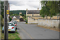
Back Lane, Winchcombe
Heading into Winchcombe with the tower of St Peter's Church visible ahead.
Image: © Bill Boaden
Taken: 20 Jul 2015
0.13 miles
9
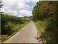
Ascend the hill
From the main road in Winchcombe, the Gloucestershire Way ascends Langley Hill, soon passing the houses on the lower slopes.
Image: © Michael Dibb
Taken: 10 Jul 2011
0.14 miles
10
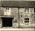
Winchcombe - Gloucester Street
Garage and Studio next to Balloon House before it was converted into Balloon Cottage.
Image: © Peter Randall-Cook
Taken: Unknown
0.15 miles