
IMAGES TAKEN NEAR TO
Ashway, CHELTENHAM, GL54 3PB
Introduction
This page details the photographs taken nearby to Ashway, GL54 3PB by members of the Geograph project.
The Geograph project started in 2005 with the aim of publishing, organising and preserving representative images for every square kilometre of Great Britain, Ireland and the Isle of Man.

There are currently over 7.5m images from over14,400 individuals and you can help contribute to the project by visiting https://www.geograph.org.uk
Image Map
Images are licensed for reuse under creativecommons.org/licenses/by-sa/2.0
Notes
- Clicking on the map will re-center to the selected point.
- The higher the marker number, the further away the image location is from the centre of the postcode.
Image Listing (13 Images Found)
Images are licensed for reuse under creativecommons.org/licenses/by-sa/2.0
Image
Details
Distance
2
Eastington Road at the junction of East End
Image: © David Howard
Taken: 17 Sep 2017
0.10 miles

5

Dutton Leys. Northleach
A small modern cul-de-sac housing estate
Image: © David Smith
Taken: 28 Sep 2025
0.15 miles
6
Valley of the River Leach east of Northleach
Image: © Stuart Logan
Taken: 13 Apr 2014
0.17 miles
7
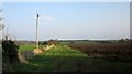
Farmland near Northleach
From the Monarch's Way following Farmington Road northeast of the town.
Image: © Derek Harper
Taken: 8 Apr 2015
0.18 miles
8
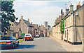
Northleach, 1994: High Street
View west, entering the town on the former main road (A40) from Burford, Witney, Oxford and London, for which a by-pass had long since been provided around Northleach.
Image: © Ben Brooksbank
Taken: 13 Jun 1994
0.21 miles
9

Field by the Monarch's Way
A view from a belt of trees by Farmington Road (Image]).
Image: © Derek Harper
Taken: 8 Apr 2015
0.23 miles
10
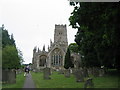
Northleach: Parish Church of St Peter and St Paul
View of eastern end of church
Image: © Nick Robinson
Taken: 31 Jul 2005
0.24 miles