
IMAGES TAKEN NEAR TO
Hampnett, CHELTENHAM, GL54 3NN
Introduction
This page details the photographs taken nearby to GL54 3NN by members of the Geograph project.
The Geograph project started in 2005 with the aim of publishing, organising and preserving representative images for every square kilometre of Great Britain, Ireland and the Isle of Man.

There are currently over 7.5m images from over14,400 individuals and you can help contribute to the project by visiting https://www.geograph.org.uk
Image Map
Images are licensed for reuse under creativecommons.org/licenses/by-sa/2.0
Notes
- Clicking on the map will re-center to the selected point.
- The higher the marker number, the further away the image location is from the centre of the postcode.
Image Listing (61 Images Found)
Images are licensed for reuse under creativecommons.org/licenses/by-sa/2.0
Image
Details
Distance
1
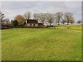
Old School House
Old School House Hampnett
Image: © Shaun Ferguson
Taken: 3 Jan 2020
0.02 miles
2
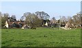
Hampnett Green
From about the same position as Image, looking to the left. The house on the left is the (probably C17) former School House. Other houses in the image also appear in Image
Image: © Derek Harper
Taken: 8 Apr 2015
0.03 miles
3
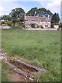
Water trough and cottage, Hampnett
The water trough has seen better days.
Image: © Philip Halling
Taken: 19 Aug 2006
0.05 miles
4
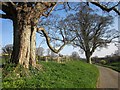
Trees, Hampnett
Oak trees which can be recognised from Image
Image: © Derek Harper
Taken: 8 Apr 2015
0.05 miles
5
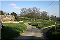
Hampnett
Taken a little further down the lane shown in Image], showing The Crooked House, which bears the date 1799 http://www.britishlistedbuildings.co.uk/en-130036-the-crooked-house-hampnett-gloucestershi , on the left.
Image: © Derek Harper
Taken: 8 Apr 2015
0.05 miles
6
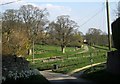
Hampnett
From the lane entering the village from the north, looking down the green.
Image: © Derek Harper
Taken: 8 Apr 2015
0.05 miles
7
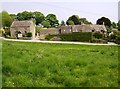
Hampnett village green
Hampnett is a strung out village. Here at the north end is the nearest that could be called a village green, but more like a meadow. The houses are set back around it.
Image: © Graham Horn
Taken: 29 Apr 2007
0.06 miles
8
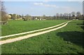
Bridleway, Hampnett
The white limestone track shown in Image, seen from the opposite direction, with the church and part of the village on the left.
Image: © Derek Harper
Taken: 8 Apr 2015
0.07 miles
9
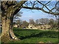
Houses at Hampnett
"One group of houses stands at the north end of the green, close to an abandoned well and a stone thought to be the base of an ancient cross" http://www.british-history.ac.uk/vch/glos/vol9/pp81-91 . This view of them is from bridleway KHA 7/1.
Image: © Derek Harper
Taken: 8 Apr 2015
0.07 miles
10
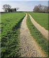
Bridleway, Hampnett
Bridleway KHA 7/1 follows this white track up the west side of the extensive green at Hampnett. On the left is the barn shown in
Image
Image: © Derek Harper
Taken: 8 Apr 2015
0.07 miles