
IMAGES TAKEN NEAR TO
Fossebridge, CHELTENHAM, GL54 3JP
Introduction
This page details the photographs taken nearby to GL54 3JP by members of the Geograph project.
The Geograph project started in 2005 with the aim of publishing, organising and preserving representative images for every square kilometre of Great Britain, Ireland and the Isle of Man.

There are currently over 7.5m images from over14,400 individuals and you can help contribute to the project by visiting https://www.geograph.org.uk
Image Map
Images are licensed for reuse under creativecommons.org/licenses/by-sa/2.0
Notes
- Clicking on the map will re-center to the selected point.
- The higher the marker number, the further away the image location is from the centre of the postcode.
Image Listing (38 Images Found)
Images are licensed for reuse under creativecommons.org/licenses/by-sa/2.0
Image
Details
Distance
1
![A walk around the Fosse Way [87]](https://s1.geograph.org.uk/geophotos/07/00/01/7000197_d3759bb4_120x120.jpg)
A walk around the Fosse Way [87]
Originally a pair of cottages, now one, Raybrook Cottage has been extended at both ends. Built in the late 18th or early 19th century, of coursed, squared and dressed limestone under a stone slate roof. Listed, grade II, with details at: https://historicengland.org.uk/listing/the-list/list-entry/1340908
Starting at Fossebridge, where the Fosse Way descends precipitously to cross the River Coln, the walk gently ascends on a road and then a bridleway to meet a minor road which is part of the Salt Way. After using the Salt Way to cross the Fosse Way the route descends on footpaths and minor roads via Oxpens Farm and Stowell Mill to return to Fossebridge.
Image: © Michael Dibb
Taken: 15 Jun 2021
0.01 miles
2
![A walk around the Fosse Way [86]](https://s3.geograph.org.uk/geophotos/06/99/84/6998431_170f5393_120x120.jpg)
A walk around the Fosse Way [86]
The Old Forge is a substantial property. There is another view at Image
Starting at Fossebridge, where the Fosse Way descends precipitously to cross the River Coln, the walk gently ascends on a road and then a bridleway to meet a minor road which is part of the Salt Way. After using the Salt Way to cross the Fosse Way the route descends on footpaths and minor roads via Oxpens Farm and Stowell Mill to return to Fossebridge.
Image: © Michael Dibb
Taken: 15 Jun 2021
0.05 miles
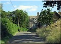
4
![A walk around the Fosse Way [85]](https://s1.geograph.org.uk/geophotos/06/99/84/6998429_e3bc313e_120x120.jpg)
A walk around the Fosse Way [85]
The Old Forge is a substantial property. There is another view at Image
Starting at Fossebridge, where the Fosse Way descends precipitously to cross the River Coln, the walk gently ascends on a road and then a bridleway to meet a minor road which is part of the Salt Way. After using the Salt Way to cross the Fosse Way the route descends on footpaths and minor roads via Oxpens Farm and Stowell Mill to return to Fossebridge.
Image: © Michael Dibb
Taken: 15 Jun 2021
0.06 miles
5
![A walk around the Fosse Way [88]](https://s3.geograph.org.uk/geophotos/07/00/01/7000199_0d66f286_120x120.jpg)
A walk around the Fosse Way [88]
From the minor road this footpath runs along Hedgley Bottom to Lower Chedworth.
Starting at Fossebridge, where the Fosse Way descends precipitously to cross the River Coln, the walk gently ascends on a road and then a bridleway to meet a minor road which is part of the Salt Way. After using the Salt Way to cross the Fosse Way the route descends on footpaths and minor roads via Oxpens Farm and Stowell Mill to return to Fossebridge.
Image: © Michael Dibb
Taken: 15 Jun 2021
0.08 miles
6
![A walk around the Fosse Way [84]](https://s0.geograph.org.uk/geophotos/06/99/84/6998428_0bfe3fed_120x120.jpg)
A walk around the Fosse Way [84]
A recently built house, constructed using traditional materials.
Starting at Fossebridge, where the Fosse Way descends precipitously to cross the River Coln, the walk gently ascends on a road and then a bridleway to meet a minor road which is part of the Salt Way. After using the Salt Way to cross the Fosse Way the route descends on footpaths and minor roads via Oxpens Farm and Stowell Mill to return to Fossebridge.
Image: © Michael Dibb
Taken: 15 Jun 2021
0.10 miles
7
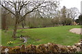
Ornamental lake and water features at Fossebridge
Image: © Roger Davies
Taken: 25 Apr 2008
0.13 miles
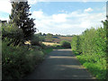
9
![A walk around the Fosse Way [89]](https://s1.geograph.org.uk/geophotos/07/00/02/7000201_a9339411_120x120.jpg)
A walk around the Fosse Way [89]
Elm Villa is a detached house dated 1844. Constructed of coursed, squared and dressed limestone under a slate roof. At the front are some fine cast iron railings and gate on a low ashlar wall. Listed, grade II, with details at: https://historicengland.org.uk/listing/the-list/list-entry/1090218
Starting at Fossebridge, where the Fosse Way descends precipitously to cross the River Coln, the walk gently ascends on a road and then a bridleway to meet a minor road which is part of the Salt Way. After using the Salt Way to cross the Fosse Way the route descends on footpaths and minor roads via Oxpens Farm and Stowell Mill to return to Fossebridge.
Image: © Michael Dibb
Taken: 15 Jun 2021
0.14 miles
10
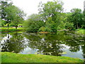
Pond at the Foss Bridge Inn
An unusually large water feature to the rear of an inn on the Fosse Way.
Image: © Jonathan Billinger
Taken: 27 Jul 2011
0.15 miles