
IMAGES TAKEN NEAR TO
Haycroft Road, CHELTENHAM, GL54 3DY
Introduction
This page details the photographs taken nearby to Haycroft Road, GL54 3DY by members of the Geograph project.
The Geograph project started in 2005 with the aim of publishing, organising and preserving representative images for every square kilometre of Great Britain, Ireland and the Isle of Man.

There are currently over 7.5m images from over14,400 individuals and you can help contribute to the project by visiting https://www.geograph.org.uk
Image Map
Images are licensed for reuse under creativecommons.org/licenses/by-sa/2.0
Notes
- Clicking on the map will re-center to the selected point.
- The higher the marker number, the further away the image location is from the centre of the postcode.
Image Listing (26 Images Found)
Images are licensed for reuse under creativecommons.org/licenses/by-sa/2.0
Image
Details
Distance
1
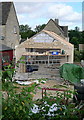
New garage
This shows typical modern construction. The walls are made of breeze block, then a facing of Cotswold stone is added. The tendency to have different size blocks of stone is fairly modern (since 1960s) and indicates that these are pre-fabricated.
Image: © Graham Horn
Taken: 12 Sep 2012
0.01 miles
3
Haycroft Road
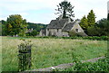
Some of the Cotswold stone cottages at the west end of Sherborne village.
Image: © Graham Horn
Taken: 12 Sep 2012
0.03 miles
4
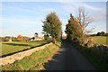
Approaching Sherborne
From Farmington.
Image: © andrew auger
Taken: 13 Oct 2009
0.08 miles
5
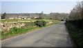
Approaching Sherborne
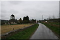
The road shown in Image] approaches the crossroads near the west end of the village.
Image: © Derek Harper
Taken: 9 Apr 2015
0.14 miles
6
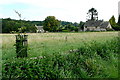
Meadow at Haycroft Road
This has been left to grass.
Image: © Graham Horn
Taken: 12 Sep 2012
0.14 miles
7
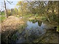
Sherborne Brook
Looking upstream from the listed bridge on the road to Goms Hole. Image] looks downstream.
Image: © Derek Harper
Taken: 9 Apr 2015
0.14 miles
8
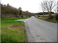
The road to Ewe Pen
This photo is taken from the crossroads seen in Image
Image: © David Purchase
Taken: 27 Dec 2011
0.15 miles
10
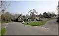
Grass triangle, Sherborne
The road from Radbutt's Corner into the Sherborne Brook valley crosses the winding lane through the village, which runs along the southern valley slopes.
Image: © Derek Harper
Taken: 9 Apr 2015
0.15 miles