
IMAGES TAKEN NEAR TO
Sherborne, CHELTENHAM, GL54 3DW
Introduction
This page details the photographs taken nearby to GL54 3DW by members of the Geograph project.
The Geograph project started in 2005 with the aim of publishing, organising and preserving representative images for every square kilometre of Great Britain, Ireland and the Isle of Man.

There are currently over 7.5m images from over14,400 individuals and you can help contribute to the project by visiting https://www.geograph.org.uk
Image Map
Images are licensed for reuse under creativecommons.org/licenses/by-sa/2.0
Notes
- Clicking on the map will re-center to the selected point.
- The higher the marker number, the further away the image location is from the centre of the postcode.
Image Listing (50 Images Found)
Images are licensed for reuse under creativecommons.org/licenses/by-sa/2.0
Image
Details
Distance
1
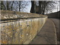
Cemetery wall, Sherborne
Running alongside the winding road through the village, with a lych gate into the cemetery ahead. The road is followed by NCN57.
Image: © Derek Harper
Taken: 9 Apr 2015
0.00 miles
2
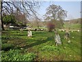
Cemetery, Sherborne
From beside the lych gate visible in Image
Image: © Derek Harper
Taken: 9 Apr 2015
0.00 miles
3
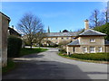
Road to the heart of the village, Sherborne, Gloucestershire
The Sherborne Park Estate is managed by the National Trust
Image: © Ruth Sharville
Taken: 17 Mar 2019
0.01 miles
4
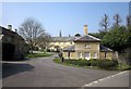
Buildings by Sherborne House
The East Lodge http://list.historicengland.org.uk/resultsingle.aspx?uid=1303063&searchtype=mapsearch and the stable block http://list.historicengland.org.uk/resultsingle.aspx?uid=1090440&searchtype=mapsearch to the house, with the Estate Office (itself formerly a stable block http://list.historicengland.org.uk/resultsingle.aspx?uid=1090400&searchtype=mapsearch ) on the left.
Image: © Derek Harper
Taken: 9 Apr 2015
0.01 miles
5
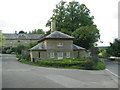
Lodge at the edge of the Sherborne estate yard
Image: © Sarah Charlesworth
Taken: 20 May 2011
0.01 miles
6

Road through Sherborne passing cemetery on the right
Image: © Luke Shaw
Taken: 12 Jul 2025
0.03 miles
7
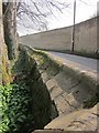
Cemetery wall, Sherborne
From the bay by the lych gate seen in Image The high wall ("c2.5m-3.5m in height") opposite encloses the kitchen gardens of Sherborne House, and is listed http://www.britishlistedbuildings.co.uk/en-130645-wall-from-entrance-to-sherborne-gardens-#.VgKhZH3-tuQ .
Image: © Derek Harper
Taken: 9 Apr 2015
0.05 miles
8

Wall of cemetery on north side of road through Sherborne
There is an Ordnance Survey benchmark Image on the wall pier to the left of the bicycle
Image: © Luke Shaw
Taken: 12 Jul 2025
0.05 miles
9

Benchmark on corner wall pier of cemetery on north side of road
Ordnance Survey cut mark benchmark levelled at 129.6500m above Newlyn Datum verified 1974
Image: © Luke Shaw
Taken: 12 Jul 2025
0.06 miles
10
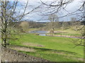
Looking towards Sherborne Brook, Sherborne, Gloucestershire
The view is taken from the village cemetery. The brook is a tributary of the River Windrush.
Image: © Ruth Sharville
Taken: 17 Mar 2019
0.06 miles