
IMAGES TAKEN NEAR TO
Notgrove Station, CHELTENHAM, GL54 3BU
Introduction
This page details the photographs taken nearby to Notgrove Station, GL54 3BU by members of the Geograph project.
The Geograph project started in 2005 with the aim of publishing, organising and preserving representative images for every square kilometre of Great Britain, Ireland and the Isle of Man.

There are currently over 7.5m images from over14,400 individuals and you can help contribute to the project by visiting https://www.geograph.org.uk
Image Map
Images are licensed for reuse under creativecommons.org/licenses/by-sa/2.0
Notes
- Clicking on the map will re-center to the selected point.
- The higher the marker number, the further away the image location is from the centre of the postcode.
Image Listing (26 Images Found)
Images are licensed for reuse under creativecommons.org/licenses/by-sa/2.0
Image
Details
Distance
1
![Route of the line [2]](https://s2.geograph.org.uk/geophotos/03/09/06/3090674_dd7015c6_120x120.jpg)
Route of the line [2]
The A436 road runs along the top of a ridge affording excellent views in both directions. This view is looking south west from the road with the line of trees marking the route of the dismantled Banbury to Cheltenham Direct Railway. The line opened in stages from 1855 to 1881 and finally closed to passengers in 1962.
Image: © Michael Dibb
Taken: 22 Jul 2012
0.05 miles
2
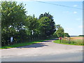
Camp on the line
The driveway leads from the A436 road to a caravan site where most of the pitches are situated on the trackbed of the dismantled Banbury to Cheltenham Direct Railway. The line opened in stages from 1855 to 1881 and finally closed to passengers in 1962.
Image: © Michael Dibb
Taken: 22 Jul 2012
0.08 miles
3
![Overgrown track [2]](https://s1.geograph.org.uk/geophotos/03/09/03/3090377_578e9007_120x120.jpg)
Overgrown track [2]
The track is now no more than a narrow, overgrown footpath as it continues to ascend towards the A436 road.
Image: © Michael Dibb
Taken: 22 Jul 2012
0.13 miles
4
![Overgrown track [1]](https://s2.geograph.org.uk/geophotos/03/08/57/3085750_b0940e7f_120x120.jpg)
Overgrown track [1]
As it starts to ascend towards the A436 road, the track deteriorates and becomes little more than a footpath.
Image: © Michael Dibb
Taken: 22 Jul 2012
0.13 miles
5
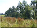
New Covert
The extensive woodland is seen from the track.
Image: © Michael Dibb
Taken: 22 Jul 2012
0.14 miles
6
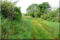
Route to Salperton
Leaving the A436 we pass the long barrow on the left hand side then head along this route, marked on the map a 'other route with public access'. It is to all intents and purposes only footpath width, and very overgrown for about 100 yards beyond here.
Image: © Graham Horn
Taken: 10 Sep 2012
0.14 miles
7

Red field, green field
Poppies and grassland. Seen from the track.
Image: © Michael Dibb
Taken: 22 Jul 2012
0.15 miles
8
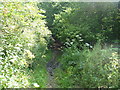
Muddy valley bottom
The track, now no longer used by vehicles, has deteriorated and now becomes somewhat muddy as it crosses the valley bottom before starting the ascent towards the A436 road.
Image: © Michael Dibb
Taken: 22 Jul 2012
0.18 miles
9

The view from the hill
As the track ascends towards the A436 road, a panorama opens up. There is a multitude of wild flowers and poppies. The woodland is New Covert.
Image: © Michael Dibb
Taken: 22 Jul 2012
0.18 miles
10
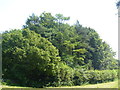
New Covert
The patch of woodland, which is quite extensive, is seen from the track.
Image: © Michael Dibb
Taken: 22 Jul 2012
0.19 miles