
IMAGES TAKEN NEAR TO
/Village Avenue, CHELTENHAM, GL54 3AS
Introduction
This page details the photographs taken nearby to /Village Avenue, GL54 3AS by members of the Geograph project.
The Geograph project started in 2005 with the aim of publishing, organising and preserving representative images for every square kilometre of Great Britain, Ireland and the Isle of Man.

There are currently over 7.5m images from over14,400 individuals and you can help contribute to the project by visiting https://www.geograph.org.uk
Image Map
Images are licensed for reuse under creativecommons.org/licenses/by-sa/2.0
Notes
- Clicking on the map will re-center to the selected point.
- The higher the marker number, the further away the image location is from the centre of the postcode.
Image Listing (64 Images Found)
Images are licensed for reuse under creativecommons.org/licenses/by-sa/2.0
Image
Details
Distance
1

Dovecote: Naunton
Situated in the centre of the grid square, the dovecote is to be found north of the B4068 and south of the main street running through the centre of the village.
Image: © Pam Brophy
Taken: 9 Sep 2004
0.05 miles
2

Interior of dovecote
Boulins, or pigeon holes, inside the dovecote in Naunton.
Image: © Philip Halling
Taken: 29 Apr 2023
0.05 miles
3

Interior of dovecote
Boulins, or pigeon holes, inside the dovecote in Naunton.
Image: © Philip Halling
Taken: 29 Apr 2023
0.05 miles

5

The Dovecote in Naunton
This 17th century dovecote is a Grade II* listed building. In 1997, there was a planning application to turn the building into a bed and breakfast establishment. The villagers fought the application and were, in 1999, as The Naunton Village Trust, able to purchase the dovecote.
Image: © Michael Dibb
Taken: 2 Aug 2010
0.05 miles
7
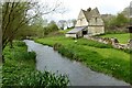
Dovecote at Naunton
The dovecote beside the River Windrush in the village of Naunton. The building is Grade II* listed https://historicengland.org.uk/listing/the-list/list-entry/1155655?section=official-list-entry and thought to date from the 16th century.
Image: © Philip Halling
Taken: 29 Apr 2023
0.06 miles
8

River Windrush
The river is seen from the bridge near the dovecote.
Image: © Michael Dibb
Taken: 2 Aug 2010
0.06 miles
9

Footpath in the Windrush valley at Naunton
Naunton church can be seen to the right in the background. The Diamond Way follows this footpath.
Image: © Philip Halling
Taken: 29 Apr 2023
0.09 miles
10

Paths cross
The view is from the footpath climbing the hill towards the B4068. The combined Diamond Way and Warden's Way come from the left and pass through the gate, over the river and up the lane into the village. A footpath goes to the right along the river bank.
Image: © Michael Dibb
Taken: 2 Aug 2010
0.09 miles