
IMAGES TAKEN NEAR TO
Heron Close, CHELTENHAM, GL54 2RR
Introduction
This page details the photographs taken nearby to Heron Close, GL54 2RR by members of the Geograph project.
The Geograph project started in 2005 with the aim of publishing, organising and preserving representative images for every square kilometre of Great Britain, Ireland and the Isle of Man.

There are currently over 7.5m images from over14,400 individuals and you can help contribute to the project by visiting https://www.geograph.org.uk
Image Map
Images are licensed for reuse under creativecommons.org/licenses/by-sa/2.0
Notes
- Clicking on the map will re-center to the selected point.
- The higher the marker number, the further away the image location is from the centre of the postcode.
Image Listing (25 Images Found)
Images are licensed for reuse under creativecommons.org/licenses/by-sa/2.0
Image
Details
Distance
1
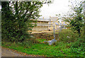
New housing development on the edge of Bourton-on-the-Water
There is an insatiable demand for new housing.
Image: © Bill Boaden
Taken: 20 Oct 2017
0.02 miles
2
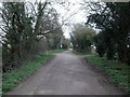
Moor Lane
The lane is a restricted byway and forms part of the Oxfordshire Way.
Image: © Michael Dibb
Taken: 2 Apr 2011
0.07 miles
3
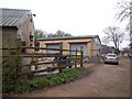
Moors Farm
Seen from Moor Lane. The notice on the fence says Beware of the Geese"
Image: © Michael Dibb
Taken: 2 Apr 2011
0.12 miles
4
Long building
The long building seen across the field from Moor Lane is part of the Industrial Park.
Image: © Michael Dibb
Taken: 2 Apr 2011
0.13 miles
5
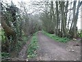
Oxfordshire Way
Moor Lane ends at Moors Farm. There the Oxfordshire Way makes a 90 degree turn to the right to run along this track, originally a footpath, but now a bridleway.
Image: © Michael Dibb
Taken: 2 Apr 2011
0.14 miles
6
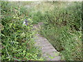
A short hop
There are plenty of low-lying areas in and around Bourton-on-the-Water, as well as a large expanse of gravel beds. This little wooden bridge allows walkers to cross the brook as part of the Oxfordshire Way. The presence of some fabric markers indicate someone must hold it high regard.
Image: © Neil Owen
Taken: 6 Aug 2014
0.17 miles
7
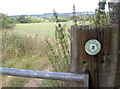
The Gustav Holst Way
There are a lot of footpaths through and around Bourton-on-the-Water. Surprisingly, this one appears as The Gustav Holst Way as it leaves the village and crosses the old Salmonsbury area. The path itself was created in 2011 as a tribute to Cheltenham's famous classical composer and takes in a 35 mile route through the Cotswolds to Wyck Rissington. It was there that Holst played the church organ, but only earning £4 a year he could not afford to travel by any other means, hence walking was a necessity as well as a great pleasure.
See Image] for a wider view of the gate as it stands atop the old embankments of the Early Iron Age camp - Salmonsbury.
Image: © Neil Owen
Taken: 6 Aug 2014
0.17 miles
8
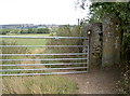
On top of the ramparts
This gate, also on the Gustav Holst Way, is actually on top of some large earthworks. It is part of the Salmonsbury area, just to the north-east of Bourton-on-the-Water, and was an Early Iron Age encampment. The enclosed section included double ditches and ramparts and takes in an unusually large swathe of land; it occupies a flat gravel-rich plain between higher ground and is thought to be more like a market area rather than a fort. Discoveries include currency bars, but the place is known by its Saxon name - Salmonsbury. Other finds include evidence of occupation by the Belgae tribe for a time too about the time of the Roman invasion.
Image: © Neil Owen
Taken: 6 Aug 2014
0.17 miles
9
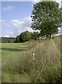
Following the embankment
A choice of routes here, either path eventually rejoining up later.
Image: © Neil Owen
Taken: 6 Aug 2014
0.17 miles
10
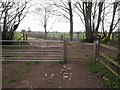
Ways cross
Seen from the information board for the Greystones Nature Reserve Image the bridleway that is the combined Oxfordshire Way and Diamond Way comes to the track where they separate. The bridleway that is the Oxfordshire Way turns right towards Moor Farm. The Diamond Way, as a footpath, turns left towards the lakes. Another footpath goes straight across the track towards Moor Lane.
Image: © Michael Dibb
Taken: 2 Apr 2011
0.18 miles