
IMAGES TAKEN NEAR TO
Market Close, CHELTENHAM, GL54 2HE
Introduction
This page details the photographs taken nearby to Market Close, GL54 2HE by members of the Geograph project.
The Geograph project started in 2005 with the aim of publishing, organising and preserving representative images for every square kilometre of Great Britain, Ireland and the Isle of Man.

There are currently over 7.5m images from over14,400 individuals and you can help contribute to the project by visiting https://www.geograph.org.uk
Image Map
Images are licensed for reuse under creativecommons.org/licenses/by-sa/2.0
Notes
- Clicking on the map will re-center to the selected point.
- The higher the marker number, the further away the image location is from the centre of the postcode.
Image Listing (118 Images Found)
Images are licensed for reuse under creativecommons.org/licenses/by-sa/2.0
Image
Details
Distance
1
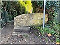
Stone Stile, Bourton on the Water
Off Station Road on Gloucestershire footpath HBW/4 looking SW from the road.
The view looking out is Image
Image: © Jayne Tovey
Taken: 30 Oct 2023
0.02 miles
2
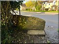
Stone Stile, Bourton on the Water
Off Station Road on Gloucestershire footpath HBW/4 looking NE to the road.
The view looking in is Image
Image: © Jayne Tovey
Taken: 30 Oct 2023
0.02 miles
3
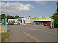
Co-op in Bourton
Entrance to the store on the edge of town.
Image: © Neil Owen
Taken: 6 Aug 2014
0.06 miles
4
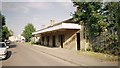
Bourton-on-the-Water railway station
Built in the 1930s, the station survived nearly half a century after the line's closure to passenger traffic in 1962. Situated in later years incongruously on the edge of an industrial estate, it was finally demolished in 2009.
Image: © Jonathan Hutchins
Taken: Unknown
0.06 miles
5
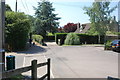
The Wardens' Way
A section of the long distance footpath passing through part of Bourton.
Image: © Trevor Harris
Taken: 24 Jul 2014
0.07 miles
6
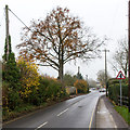
Station Road
This is the main route into and out of Bourton-on-the-Water.
Image: © David P Howard
Taken: 20 Nov 2014
0.08 miles
7
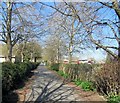
The Avenue, Bourton on the Water
path running between St Lawrence Church and the Primary school
Image: © Paul Gillett
Taken: 14 Apr 2015
0.08 miles
8
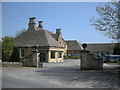
Bourton On The Water-Moore Cottage Hospital
On Moore Road, a Grade II listed building built in 1928.
Image: © Ian Rob
Taken: 22 Apr 2011
0.09 miles
10
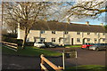
Salmonsbury Cottages, Bourton-on-The-Water
One of three terraces each of four properties, on three sides of a square, the fourth being bounded by Station Road.
Image: © Derek Harper
Taken: 28 Jan 2017
0.09 miles