
IMAGES TAKEN NEAR TO
Roman Way, CHELTENHAM, GL54 2EW
Introduction
This page details the photographs taken nearby to Roman Way, GL54 2EW by members of the Geograph project.
The Geograph project started in 2005 with the aim of publishing, organising and preserving representative images for every square kilometre of Great Britain, Ireland and the Isle of Man.

There are currently over 7.5m images from over14,400 individuals and you can help contribute to the project by visiting https://www.geograph.org.uk
Image Map
Images are licensed for reuse under creativecommons.org/licenses/by-sa/2.0
Notes
- Clicking on the map will re-center to the selected point.
- The higher the marker number, the further away the image location is from the centre of the postcode.
Image Listing (70 Images Found)
Images are licensed for reuse under creativecommons.org/licenses/by-sa/2.0
Image
Details
Distance
1
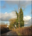
Moor Lane
The Oxfordshire Way follows footpath HBW 8/3 along this track; the footpath soon veers off to the right across fields and the track becomes restricted byway HBW 9/1.
Image: © Derek Harper
Taken: 28 Jan 2017
0.07 miles
2
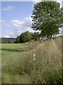
Following the embankment
A choice of routes here, either path eventually rejoining up later.
Image: © Neil Owen
Taken: 6 Aug 2014
0.08 miles
3
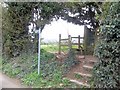
Footpath leaves the byway
A footpath leaves Moor Lane, a restricted byway. The path runs parallel to the lane for some distance before heading right across the fields.
Image: © Michael Dibb
Taken: 2 Apr 2011
0.08 miles
4
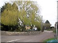
Moor Lane
Moor Lane, a restricted byway leaves Roman Way. Behind the lovely tree is Harp Farmhouse.
Image: © Michael Dibb
Taken: 2 Apr 2011
0.09 miles
5
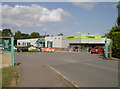
Co-op in Bourton
Entrance to the store on the edge of town.
Image: © Neil Owen
Taken: 6 Aug 2014
0.09 miles
6
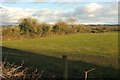
Field and boundary by Moor Lane
From the Oxfordshire Way as shown in Image], looking right.
Image: © Derek Harper
Taken: 28 Jan 2017
0.10 miles
7
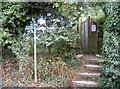
This was for the Oxfordshire Way
A restricted byway, too. Somewhere along the Way it mysteriously becomes the Gustav Holst path.
Image: © Neil Owen
Taken: 6 Aug 2014
0.10 miles
8
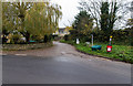
Moor Lane
Junction of Moor Lane and Roman Way.
Image: © David P Howard
Taken: 20 Nov 2014
0.11 miles
9
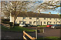
Salmonsbury Cottages, Bourton-on-The-Water
One of three terraces each of four properties, on three sides of a square, the fourth being bounded by Station Road.
Image: © Derek Harper
Taken: 28 Jan 2017
0.12 miles
10
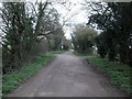
Moor Lane
The lane is a restricted byway and forms part of the Oxfordshire Way.
Image: © Michael Dibb
Taken: 2 Apr 2011
0.12 miles