
IMAGES TAKEN NEAR TO
Melville Estate, CHELTENHAM, GL54 2EU
Introduction
This page details the photographs taken nearby to Melville Estate, GL54 2EU by members of the Geograph project.
The Geograph project started in 2005 with the aim of publishing, organising and preserving representative images for every square kilometre of Great Britain, Ireland and the Isle of Man.

There are currently over 7.5m images from over14,400 individuals and you can help contribute to the project by visiting https://www.geograph.org.uk
Image Map
Images are licensed for reuse under creativecommons.org/licenses/by-sa/2.0
Notes
- Clicking on the map will re-center to the selected point.
- The higher the marker number, the further away the image location is from the centre of the postcode.
Image Listing (27 Images Found)
Images are licensed for reuse under creativecommons.org/licenses/by-sa/2.0
Image
Details
Distance
1
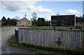
The Catholic church
This is a very small church by normal RC standards, and is a daughter church of the one in Stow-on-the Wold.
Image: © Bill Boaden
Taken: 8 Apr 2010
0.04 miles
2
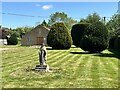
St Kenelm Catholic Church
Bourton-on-the-Water
Image: © Andrew Abbott
Taken: 14 May 2022
0.07 miles
3
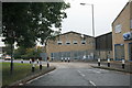
Speed hump on Bourton Industrial Estate
Image: © andrew auger
Taken: 9 Oct 2009
0.09 miles
4
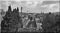
Bourton-on-the-Water Station
View eastward, towards Kingham; ex-Great Western, Cheltenham (St. James') - Andoversford - Kingham line. The station and line (from Lansdown Junction, Cheltenham) were closed to passengers 15/10/62, to goods 7/9/64.
Before World War II, the 'Ports to Ports' Express between Newcastle-on-Tyne and Swansea ran over this route, using the avoiding line at Kingham from the line from Banbury, also through coaches from Paddington to Cheltenham joined at Kingham and there was long-distance freight, including ironstone traffic from Hook Norton.
Image: © Ben Brooksbank
Taken: 27 Mar 1961
0.10 miles
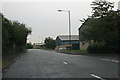
6
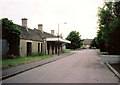
Bourton on the water Station
Remains of dismantled railway station
Image: © Raymond Knapman
Taken: Unknown
0.12 miles
7
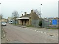
Bourton-on-the-Water Station
The disused station buildings at Bourton-on-the-Water. The station site is now occupied by the Highways Authority, with the surrounding area an industrial estate.
Image: © David Luther Thomas
Taken: 24 Mar 2007
0.14 miles
8
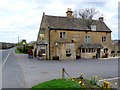
Coach and Horses
Built of Cotswold stone with a stone tile roof this old coaching inn is at the side of the A429 the Fosse Way
Image: © Nigel Mykura
Taken: 4 Apr 2011
0.15 miles
10
A429 Fosse Way Turning For Bourton-on-the-Water
Image: © Roy Hughes
Taken: 25 Mar 2017
0.15 miles