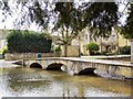
IMAGES TAKEN NEAR TO
Riverside, CHELTENHAM, GL54 2BP
Introduction
This page details the photographs taken nearby to Riverside, GL54 2BP by members of the Geograph project.
The Geograph project started in 2005 with the aim of publishing, organising and preserving representative images for every square kilometre of Great Britain, Ireland and the Isle of Man.

There are currently over 7.5m images from over14,400 individuals and you can help contribute to the project by visiting https://www.geograph.org.uk
Image Map
Images are licensed for reuse under creativecommons.org/licenses/by-sa/2.0
Notes
- Clicking on the map will re-center to the selected point.
- The higher the marker number, the further away the image location is from the centre of the postcode.
Image Listing (633 Images Found)
Images are licensed for reuse under creativecommons.org/licenses/by-sa/2.0
Image
Details
Distance
1
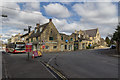
Village Centre, Bourton-on-the-Water, Gloucestershire
As seen from the Rissington Road.
Image: © Christine Matthews
Taken: 12 Mar 2013
0.01 miles
2
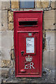
Queen Elizabeth II Postbox, Bourton-on-the-Water, Gloucestershire
This postbox is outside the Post Office.
Image: © Christine Matthews
Taken: 12 Mar 2013
0.01 miles
3
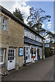
Shops, Bourton-on-the-Water, Gloucestershire
These shops are near the junction with Rissington Road.
Image: © Christine Matthews
Taken: 12 Mar 2013
0.01 miles
4
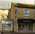
Puzzled by Sweet Memory's
As an old pedant, I certainly am. This is on Bourton-on-The-Water's High Street.
Image: © Derek Harper
Taken: 28 Jan 2017
0.01 miles
6
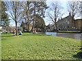
Alongside the River Windrush
An idyllic scene on the first warm day of spring
Image: © Paul Gillett
Taken: 14 Apr 2015
0.01 miles
7
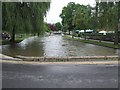
River Windrush
Normally on a summer Saturday this scene would be full of tourists. The torrential rain on Friday 20th and following floods left Bourton-on-the Water almost deserted. The water level has dropped enough now to allow movement through the village.
Image: © David Luther Thomas
Taken: 21 Jul 2007
0.01 miles
8
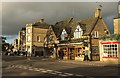
Shops, Bourton-on-The-Water
These buildings on the High Street are also shown in Image] and Image Once again, I've failed to show the Venetian window on Hartley House https://www.historicengland.org.uk/listing/the-list/list-entry/1088777 on the left.
Image: © Derek Harper
Taken: 28 Jan 2017
0.01 miles
9
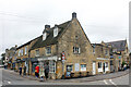
Coffee Hub and The Den, High Street, Bourton-on-the-Water
Grade II Listed as "Vaughan's (Tobacconist) and Shop on the Green" in 1983. 17th century with modern alterations. In planning files I find that shop 1 (? I assume left front) had living accommodation added and the flat roof replaced with pitched roof in 1991. Also in 1991, possibly in the rear, there was a change of use from 'The Roast Restaurant' to amusement centre but it was refused. Cotswold Sheepskin was also in one of the shops prior to 2002. IF I look on Google and other documents, I find in the rear; 2005-2011 Chinese Chef, 2014-2023 Aroma. Right front; 2004 The Corner Shop, 2009-2011 The Laurel Tree, 2014-2015 Waffle Corner, 2017-2018 Baguettes on the Water, 2021-2023 Coffee Hub. Left front; 2009 Willow, 2011 Timeless Tales, 2014 Stuart Fletcher Top Glass, June 2015 empty, 2017-2023 Coffee Hub.
Image: © Jo and Steve Turner
Taken: 12 Mar 2023
0.01 miles